Wednesday, April 9, 2008

N951CC to CA Day 4 ** UPDATE **

Well like I said, sometimes they just put out AIRMETs for turbulence for an entire area. This was the case today. I checked the weather again about noon and there were 2 pilot reports of no turbulence along my route of flight. Also, the forcast for China Lake was updated and it was supposed to be calm winds. With this news I quickly asked the motel staff for a ride to the airport. The person who would give me a ride to the airport was a town meeting so I had to wait awhile for him, but I was airborne by 1:45.

The ride was pretty rough during the climb out and I leveled off at 8,500 ft since the were stronger head winds higher. There was continuous light chop at this altitude so I decided I would rather have a longer flight if it was smoother so I climbed up to 10,500 ft and it was smooth. I did lose about 12 knots of groundspeed, but it was a nice ride for the most part all the way into Inyokern.

Through the Palmdale - Mojave area, I was flying through smooth up and down drafts. I was getting + / - 1500 ft / min rates of climb / descent. It was pretty hard to keep a constant altitude. I called approach control to verify there was no conflicting traffic and to verify he was seeing the same altitude variations (so it wouldn't just be my pitot-static system). He confirmed and shortly after a Gulfstream jet flying into Palmdale reported updrafts as well. Anyways, they were smooth so it wasn't so bad. I had a tough time descending down into Inyokern because of the updrafts, but I circled for a while and eventually got down to pattern altitude.

The airplane is now tied down in it's shade hanger at Inyokern safe and sound. I'll have my mechanic take a look at the vacuum pump and door lock soon. Oh, the pilot door lock broke too. I think it might just be the retaining clip. I heard something fall inside the door and then the tumbler pulled out of the hole still on the key leaving a hole in the door. "Due to national security..." I have to have my door locked so I need to get this fixed ASAP.

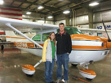
I didn't take too many pictures of the trip. I guess I should have taken pictures of the airports I landed at, but I only got one of it tied down at IYK. Anyways, here is a slideshow of the pictures I did take.

http://picasaweb.google.com/jayson.brouchoud/N951CCToCA/photo#s5187462314526446306

UPDATE: Here is the GPS track of day 4 to CA

N951CC to CA Day 4

Well today is going to be a short post. I woke up bright and early and took a look out the window of my motel room. I could see the trees bending over in the wind. I called and got a briefing anyways and that confirmed the same story as yesterday afternoon. I'm not going anywhere today. After breakfast I walked over to the laundromat since I was out of clean clothes. Of course they are out of business. I talked to the motel staff and they said there was not other place in town to do laundry. So here I sit in yesterdays clothes typing about my trip to CA on my blog since I've got nothing else to do.

N951CC to CA Day 3

Since my original plan for Day 2 was to only get to Odessa, TX. I had planned my next leg to take me to Cochise, AZ (P33). Since I had made it to Winkler, I could now extend that leg a little. I wanted to extend this leg a little because otherwise I'd have to make a quick stop and a short flight near Inyokern. If I could extend this leg, I would avoid having that last stop. My plan now was to fly to Marana, AZ (KAVQ) just north of Tucson, AZ. I flew that flight at 10,500 ft and it was a nice smooth flight.

On the ground getting my next weather briefing for my last leg to Inyokern, I got the usual AIRMET for turbulence and strong surface winds. Palmdale, Mojave, Edwards, Big Bear, etc already had strong surface winds, but Inyokern and China Lake (KNID) did not. Inyokern does not get TAFs (Terminal Aerodrome Forecast), but China Lake sometimes does and they weren't forcasting strong winds for a few hours. Of course I took off with a alternate in mind (Victorville, CA (KVCV)). By this point, you're probably wondering why I keep taking off into turbulence and strong winds. I'll talk about that at the end of this post.

Just like yesterday, even though I just landed in smooth air, taking off now, I was flying in continuously turbulent air. I finally got to smooth air at 9,500 ft and it stayed smooth with only occasional bumps at 10,500 ft. I was nervous about the surface winds so I called up flight watch to get an update on Victorville. You guessed it, they now had horrendous winds. So I started asking for weather closer and closer to where I was to see how far I could get before I had to land. The next two airports I was supposed fly over were the last two with good winds so I started checking them out. The options were Gila Bend, AZ (E63) or Blythe, CA (KBLH). From the map, the yellow blobs for cities looked about the same size, but Gila Bend was much closer to the city than Blythe. This means there would be a much greater chance of getting a ride into town for the night.

As I was descending into Gila Bend, I noticed that my attitude indicator was indicating a very steep dive. I know I wasn't diving because I could look out and see where I was going. My altimeter and vertical speed indicators were also normal. This was my first instrument failure of my flying career. I've had a variety of issues before including engine problems, but this was my first instrument failure. Pretty soon it was saying I was climbing sky-high in a steep left turn. I wanted to just cover it up because it was distracting, but I didn't have anything handy. I just ignored it while I came into land.

As it turns out Gila Bend is a hole in the wall tiny place. There was nothing at the airport besides an abandoned building where an office used to be. I called the local motel that was supposed to offer transportation to and form the airport, but she said she was the only one working and could not come give me a ride. She gave me a number to the other motel in town, but I got the same response. Just about then, I saw some guys pulling 2 airplanes out of a trailer. I went over and talked to them. They had 2 jet powered airplanes roughly based on Jim Bede's BD-5 micro (http://en.wikipedia.org/wiki/Image:Bd5j.jpg). I was lucky they were there because they had planned on being at the Air Force auxiliary airfield to the south (KGBN), but apparently they crashed a plane on the runway shutting the airport down. That is why these guys were up here now. One of the gentlemen was nice enough to give me a ride into town. He mentioned he was a contractor for the military and that he comes to China Lake to work with the F-18 folks. From the website on the business card, it seems like they use the airplanes as radar targets (http://www.smart-1.us/). The guy's name was Robert Bishop here is a video that was on his website that talks about his work with the jet in the James Bond movie Octopussy.

So it was only noon and I was already stuck for the day. I decided to wander around the city, which only took me an hour since its so small. Most of the shops were closed and have very limited hours and working days. Most businesses aren't open here on Sunday through Tuesdays. At least this motel has internet and with nothing else to do, I went to take a look at the FARs (Federal Aviation Regulations) to confirm that the attitude indicator is not required for VFR flight and that I would still be able to make the flight home. FAR 91.205 lists what is required and does not include an attitude indicator. This makes sense because it is just an artificial horizon. This is very important if you fly in the clouds, but since I won't be and I can just look outside at the horizon, I don't need it for my flight.

So why do I keep taking off into turbulence you ask??? Well I now live in Ridgecrest so my airplane is based out of Inyokern (KIYK). This is in the middle of the Mojave desert at the Eastern Base of the Sierra Nevada's just south of Mt. Whitney. Every day I go flying I have to deal with strong winds and turbulence. I remember the days there WASN'T an AIRMET for turbulence instead of when there was one. The winds coming over the mountains create "mountain wave" effects and create a lot of turbulence and the thermals from the desert create a lot of turbulence. If I didn't fly every time they posted an AIRMET for turbulence and wind, I would sell my airplane. The weather usually is bad, but not unflyable. You just have to be careful and have an alternate in case things get bad. And trust me things do get bad, just not every time they forecast it. So that is why I now fall under the mindset of try and see, if it's bad land otherwise its just another AIRMET for flatlanders.

UPDATE: Here is the GPS track of day 3 to CA

N951CC to CA Day 2

For day 2, I had planned at stopping at Odessa, TX (KODO) for my next stop, but after looking at the map closer, I'd be descending through class C airspace, which isn't that big of a deal, but it would be easier if I just went a little further and land at Winkler, TX (KINK). As I was getting closer, I was checking the weather at the airports and Winkler started getting very strong winds and Odessa was still in good conditions so I decided to land at Odessa anyways. It was a short stop there and I picked up the weather briefing for my next leg. There was now an AIRMET (it warns pilots of bad weather) for moderate to severe turbulence and strong winds along the route. The forecast winds at my destination were not too bad and I had just flown in with no turbulence so I figured I'd give it a shot. If it gets bad I can always turn around and land at the nearest airport.

Well of course I had turbulence on my entire climb out. I called up flight service to get an update on my destination forecast and of course that was now also bad. Winkler airport was just in front of me and the winds weren't too terribly bad at this point so I landed there for the night.

When I went to tie-down, there were only thin chains there. I'm used to regular chains with hooks on them. I asked the man in the FBO if I was supposed to tie the chains like a rope or what I was supposed to do. After harassment for quite awhile about being unprepared and not knowing the hardware that is being used at the airports, he showed me how to tie a knot with a chain. This day hadn't gone as planned so why should I figure it'd get better now? He tied it really quickly and went back into the building saying I did one, you have to figure out the rest. I must have been there for 20 minutes trying to figure out his knot. I managed to do one on the other wing tie-down, but didn't know how I did it. Eventually he drove back out and showed me again and I think I learned it. He gave me a ride into town to a motel there. At least I was safe on the ground with a room for the night.

UPDATE: Here is the GPS track of day 2 to CA

N951CC to CA Day 1

Well I'm on day 4 of my flight from Manitowoc, WI (KMTW) to Inyokern, CA (KIYK) and I'm stuck again due to weather so I might as well post about my trip this far.

Originally I had planned on leaving Monday morning (4/7/08), but the weather in WI was threatening so I had thought about leaving Sunday afternoon. My family was having a get together for a late Easter since the family wasn't together on the actual holiday. My parents had other plans that night so I'd be able to get away and start flying back to CA. The forecast became worse so I decided to take-off Sunday morning. I felt bad because I wasn't able to visit my brothers, but if I didn't get out I'd be stuck in bad weather.

Since the storm that was rolling in was also coming through the middle of the country, I flew straight south instead of south-west so that I would have an extra day of good weather in case I needed it. I had planned on flying 3 flights that day each being about 3 hours. My first stop was supposed to be in Farmington, MO (KFAM), but there was a NOTAM (notice to airmen) that the field didn't have fuel, so instead I landed nearby at Fredricktown, MO (H88). It was a little field, but a gentlemen met me at the fuel pump and gave me a hand. The fuel there was only $3.95 (cheap compared to the $5.22 I paid at De Kalb, Il (KDKB)). I was able to borrow the airports courtesy car and drive into town for lunch. After lunch I was back on my way and my next stop was in Paris, TX (KPRX). Since I was running well behind schedule, I decided not to fly the third leg and got a taxi into town.

UPDATE: I decided to upgrade Google Earth to allow GPS tracks, here was my flight for day 1 to CA.