Sunday, September 28, 2008

Visit with Julie and Pancho, and the "Bay Tour"

Saturday Michelle and I flew up to Santa Cruz (landed at nearby Watsonville) to visit with Michelle's relatives Julie, Pancho, Joan, Tom, Sarah, and Shawn at Julie and Pancho's fall party. Since we had some extra time in the morning and could carry enough fuel, we decided to try to take the "Bay Tour" before heading to Watsonville.

The Bay Tour is simply flying to the San Francisco Bay where you can fly around Alcatraz, the Golden Gate Bridge and other sites in the area. It is more complicated from the pilot's point of view because it consists of entering class Bravo airspace around San Francisco (SFO) airspace and flying in congested airspace with much larger aircraft while you transition to the north over the bay. Once you get to the bay, you're flying under the class B airspace so the controllers let you "resume own navigation", but still keep an eye out for you to help with conflicting traffic.

There was a lot of activity up there while we were there, but I found the controllers extremely helpful and considerate. Since you are in such congested airspace, they need you to follow exactly what you are told and for you to understand exactly what you are told. The controllers are talking unbelievably fast and there is no spare time for inexperience. The only problem I had the controller quickly picked up on and corrected. I thought he told me cleared to enter class Bravo airspace and to remain west of the San Jose airspace, then pick up, but stay west of the 101 Bayshore freeway. The controller confirmed my read back so I heard it properly so I guess I didn't know what he really wanted me to do.

Since I wanted to start descending I turned slightly more westbound to avoid some upcoming terrain, doing so I would remain west of the upcoming San Jose class Charlie airspace. As soon as I turned, the controller questioned what I was doing and he clarified that he wanted me to overfly class Charlie then descend to 3500 ft on my current (before I turned) heading. I guess I'm not sure who got this mixed up. Thinking back, maybe I was still being vectored. While I was talking to the prior (or even the before that) controller, when I asked if I could take the bay tour, he said sure and gave me what I wanted to do. After I told him I wanted to fly up the west side over SFO to the bridge he told me a vector to follow to be in the correct position to pick up the class Bravo transition. I thought that vector was more of a suggestion in it's context and would have long been expired, but if hadn't, then I shouldn't have started my turn. The controller was very nice and we quickly got on the same page and my bay tour went without any other issues.

Back to the actual tour, as we were flying up the peninsula, there were plenty of sights to see including San Jose International, San Francisco International, Stanford, the San-Mateo bridge, the Bay bridge, The Golden Gate bridge, and Alcatraz. As we were flying past SFO, the controller advised my of nearby traffic at my 3 o'clock down low and climbing towards me. It is usually very difficult to find other airplanes when you are flying because they are small, most are white and blend into the sky, and they are usually too far away. Not this guy, here was a jet flying right towards us. He passed behind and below us, but not by much. Soon we passed the majority surface class B airspace and we were free to navigate on our own.


I descended down to 2,500 feet as we headed towards Alcatraz to make sure I maintained 2,000 ft over the area since it is a National Park. As we flew to Alcatraz, we could see sailboats everywhere. As we circled Alcatraz, we also had a great view of fisherman's wharf. Then we flew west and overflew the Golden Gate bridge. Once we passed the bridge, we circled it to the right, then got we started on our way back. I told the controller we needed to transition back through class Bravo on our way back to Watsonville and they let us fly down the coast, which unfortunately was fogged in.


Our trip from the bay down to Watsonville was pretty uneventful. The only interesting thing is that as we were flying over Soquel and we were looking down at the Redwoods, we were wondering if this is where Julie and Pancho lived. We knew it was in this area, but didn't manage to spot their house. Later when we were at their house, I fired up the GPS to mark their location with a waypoint and I noticed that we had actually flown right over their house while we thought we were in the right area.

We grabbed a bite to eat at Zuniga's, the Mexican restaurant with very good food right on the airport as Tom and David (a friend of Tom and Joan's) came out to the airport to pick us up. After lunch we showed of the airplane to Tom and David then headed to Julie and Pancho's house. Once we got there, preparations were already well on the way for the party. We met lots of new people and enjoyed the live music of Terry and Terry out on the back deck overlooking the Redwood forest. It was a great party and I'm really glad we were able to make it up there. Unfortunately Lisa and Matt weren't able to make it, but they're planning on stopping by here next weekend so we'll be able to see them then.

This morning we got up at a relaxed pace and ate breakfast. There was no rush to get out to the airport since they were still reporting fog. Eventually we went out the airport around 1 and pre-flighted the airplane. Everything was good to go and I called flight service. The airport was reporting 900' scattered clouds, but as we watched airplanes taking off, we could see them climb out and turn staying below and clear of the clouds so we decided to head out. There was little traffic and light winds so we took off runway 8 instead of the normal runway 20. We took off and headed towards a corridor through the clouds. As it turns out, it was more of scattered to broken at 300 ft. The corridor through the clouds was plenty big and I was above the layer in no time flat, but I think I ended up below VFR conditions.

I wonder how this works because they leave the actual condition decisions up to the pilot not the automated recording and I had watched airplanes in the pattern not entering the clouds. I thought that this was enough to satisfy me that the airport was VFR, but I was obviously wrong. I wasn't ever worried about safety since I could see the edge of the cloud layer only a quarter mile or less off the end of the runway, but I really don't like to mess around with legalities when it comes to flying.

Flying back was pretty much normal, turbulence over the mountains and a headwind. Michelle found an airport that had some kind of field around it that had a maze carved through it, some day we'll have to drive there and do the maze. After 2 hours on the tach we were home once again.

Thursday, September 25, 2008

Dr. appt delayed

The doctor appt that where Michelle and I were supposed to find out the sex of our baby this last Tuesday 9/23 had to be delayed. I got sent on travel and I was really the guy to go. The other person in our group didn't work on this material and had been on travel for 2 consecutive weeks so I was on my way to DC. Michelle rescheduled it for it for 9/29, but I was already scheduled for travel to Tucson so she had to reschedule it to Friday 10/3. So until next Friday, it's still a mystery!

Monday, September 15, 2008

Mt. Whitney September 13-14, 2008

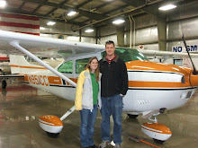
In case you aren't interested in reading this whole thing, here is the link to the pictures, and if you don't like the hat then too bad.  It keeps the sun from burning my face and ears and is worth looking like an idiot.

http://picasaweb.google.com/jayson.brouchoud/MtWhitney?authkey=yow7wtoEiJA#

So I finally got my chance to hike/climb Mt. Whitney. A few of us have wanted to climb it for the last few years, but we've never been successful getting permits through their lottery system. This year I just decided we should go anyways and try to obtain no-show permits. I've been told by a few people that have gone, that there are no-show permits available almost everyday. Rob was going to be around this weekend and Kevin was free as well. The next free weekend would be too cold for us since we don't have crampons or ice axes. Unfortunately, Rob wasn't able to make the trip since he had to be on a flight back to DC.

I decided to call the Whitney Ranger's office every day (their suggestion) to see if anybody had cancelled their reservation so that I'd be able to reserve those permits. The ranger said that most people don't show up instead of cancelling ahead of time so that I probably wouldn't get a reserved permit, but I might as well try. Last Thursday, they had some cancellations so I was able to reserve 2 overnight permits onto Whitney. If I wasn't able to get the permits, we would have had to show up at 11am on Saturday and hope people didn't show up.

The ranger told me on the phone that the deadline for picking up your permits for an overnight trip is 11am and the phone message system of the permit office said the same thing as well. However, when we showed up at the permit office at 10:15am, they said we were lucky that nobody picked up our permits as a no-show yet since they start giving them away at 10am. I tried to tell the lady that I was misinformed and that they should check their phone message, but she really didn't care. I would have been extremely upset if they would have given our permits away since they told me wrong. Anyways, everything worked out OK with the permits.

From the permit office we drove north into Lone Pine and took a left at the first (and only) light in town and headed through the Alabama Hills up towards the Mt. Whitney Portals. There is a campground and store up there along with parking for the trailhead. All of the parking spaces were full so we had to park off the road a few hundred feet down and hike our stuff to the trailhead. We spent just a little time reading the boards at the trailhead and weighing our packs before heading up the trail. My pack was 44 and Kevin's was 42 pounds so we were pretty equal. We started hiking at 11:30am, Saturday September 13th.


The beginning of the trail was nice with a slow, but steady climb across very long switchbacks. The trail was in good shape and was mostly compacted dirt and small rock. After passing a small waterfall we entered the John Muir Wilderness area. There was plenty of opportunity to look back at Lone Pine to see our progress as we hiked up. We took our first break about 2 miles in according the GPS and ate lunch around the 4 mile mark. The GPS measured the trail as being significantly longer than what is posted and my belief is the difference between the USGS survey and the GPS track. I believe the USGS survey doesn't account for the distance traveled in the switchback, but instead measures direct line from point to point. I don't have anything to back this up, but I'll look into it.


As we continued, we saw 2 parachutes overhead, I'm not sure if they were powered parachutes or just para-gliders, but they weren't regular parachutes. That would have been by far the best way down! After passing a really cool water fall that flowed over a big rock and balancing over some logs across more water we reached Lone Pine Lake. It was a short trip down to the lake so we took the side track to check it out. It was a very cool lake and we found someone to take a picture of Kevin and me.


After leaving Lone Pine Lake and continuing up, the terrain became more rocky and we passed a rock that indicated the 3 mile mark. Remember I said we ate lunch at the 4 mile mark... The terrain was becoming much more arid with very few trees and mostly rocky terrain. Eventually we came to a meadow with a stream; the water was very reddish perhaps from high iron content. At the far side of the meadow was the lower of the two campgrounds for backpackers, Outpost Camp, which is at 3.5 miles.


Not too far past Outpost Camp we came across Mirror Lake. This was a very calm lake that seemed pretty shallow and about 200 ft across. There was a group of people here eating their lunch and I wish we would have stopped to eat here instead of a mile earlier, but this was my first trip up so I didn’t know what to expect. The next little bit of trail was a series of switchbacks that climbed up from Mirror Lake so we got a better view as we continued up. Eventually the view opened up and we could also see the meadow and Outpost Camp and Lone Pine Lake down below.


Soon we were above the tree line and the terrain was extremely arid. The trail was getting more difficult with more and more rock stairs instead of the regular trail. I saw a large bird as along the trail that seemed to care less about hikers. With ~150 people hiking the trail a day, I guess it was used to people. It actually started running right towards us and I got a picture of it. I think it was some kind of Partridge.


Soon we were above the snow line, but I was still comfortable in a short sleeve shirt. The temperature was probably still in the low 60s, but I was generating more than enough heat. Up a little higher and we came across another lake, I think this was Consolation Lake. I'm pretty sure camping is now allowed there although we did see a tent there. As we kept going, Kevin ran out of water. I was trying to give him some water, but my pack wasn't working that well. We decided to keep going since the campground was supposed to be really close.

After another quarter mile, we came across Trail Camp. This is a large area that is very rocky with large boulders, but plenty of sandy flat spots between the boulders to set up tents. There was a lake right there as well for us to get out the water filter and fill our water packs. Instead of filling right at the lake, we walked to the steam inlet and got fresh water instead of the lake water right by all the campsites. It was obvious that this area was very heavily camped because many of the flat spots for tents smelt like urine. You're supposed to hike away from the lake, but you could tell that plenty of people had been too lazy. Being exhausted ourselves, we found one that wasn't terrible and started to set up camp.

It didn't take us too long to get our tents set up and we started dinner. I had a chicken and rice dinner for 2 that I had no problem finishing, Kevin finished his oriental chicken and rice for 2 as well. The meals are pretty easy to make. You just boil some water, then pour water into the food pouch and 9 minutes later you have a hot dinner. With some time before dark, we boiled some extra water and had some hot chocolate before heading to bed.


We stayed up as the moon rose over the mountains to illuminate the campground. I tried taking a few pictures, but they didn't turn out well of course. Once it was dark I headed to bed, it was only 7 or 7:30, but I was exhausted. I laid in bed for awhile before I was able to fall asleep. Last time I camped when it was cold out, I ended up freezing all night long. This time I remembered to bring my sleeping bag cocoon with me; which worked incredibly. At about 2am I woke up pretty cold. I thought the sun was starting to come out so we should get started, but it was just the moon being so bright. I put on an extra layer of clothes and I slept fine until morning.

I got up around 7am and packed my water pack for the trip to the summit and ate a PB&J sandwich for breakfast. We went back down to the stream and refilled out water for the trip up to the summit. This is the last source of water on the way up so we won't have another chance to fill up until we get back down to camp. We started the 98 switchbacks up to Trail Crest around 7:30am.

Most of the complaints I've heard about hiking Mt. Whitney are about how grueling the 98 switchbacks are. I think that camping at Trail Camp was a great idea since my legs were fresh in the morning and we had no problem getting up the switchbacks. We decided to stop and take a 15 second break every other switchback. The breaks are so short that they don't add any time to the trip, but it's enough to catch your breath and to prevent from becoming exhausted. There were a few places that were icy and exposed. One area in particular was very exposed and had a railing to prevent people from falling.


Once we got to got to Trail Crest at 13,600 ft, we could look down and see several other lakes that we couldn't before. Trail Crest is at a saddle to the south of Mt. Whitney where you cross over to the west side of the mountain. Here you start hiking down a little bit before you start a mostly flat trek across a very exposed rocky trail. A few places opened up where you would be standing on the crest of the mountain and be able to see both to the east and the west of the mountains.


After about a half a mile, you reach Mt. Whitney, but not the summit yet. There is a long hike up around the backside of the mountain where you start a few more easy switchbacks before a building comes into sight and you have reached the summit! There were two USGS markers on top and I made sure to find them and get pictures. I was also sure to get my name in the book to make it official that I had reached the top.
I had read that cell service is available at the peak due to the clear view of everywhere, but even though I had 2 to 3 bars, I couldn't get any calls to go through, so much for calling Rob and rubbing it in!


While we were sitting there enjoying the view, I pulled out two cold Miller Lites. That beer was one of the best I ever had, and yes I did carry it more than 11 miles and over a mile vertically to drink it on top of the US (at least the lower 48). To get a perspective of how high Mt. Whitney is, we were almost 3 times higher than Denver at almost 3 miles up from sea level. This is equal to the service ceiling of my airplane and higher than I've ever flown before. I would need to be on oxygen to legally fly this high.


Wow, I remember this picture; I was standing on the edge of a 2,500 foot cliff.  That drop-off went down essentially to where we had camped for the night, down at only 12,000 feet!

This picture almost seems fake, but that's what it looked like from up so high.

The way back down to Trail Camp was pretty much the same as the way up except for much faster and easier. It took us 4 hours to hike from Trail Camp to the summit and only 2 to hike back down. Once we got to trail camp, Kevin laid down to rest his feet for awhile and I started to tear down my tent. Kevin didn't rest long; I think he felt rushed since I was tearing down my tent. I told him he could keep resting, but he got up anyways and soon we were packed and ready for the hike back down to the portals. Just before we left, we checked our water and we were both still fine so we didn't spend the time to top off our water packs.

I don't remember the hike up having so many steep steps, but I sure did notice them on the way down. By far the hardest part of this hike was carrying the backpacks down the last 6 miles. I was very happy once Lone Pine Lake came back into sight because that meant we were making progress downwards. Not soon enough we were back down below the tree line and we could see Mirror Lake. With about 4 miles left to go, my legs started to shake as I walked and my knees were killing me. I just started to zone everything out and concentrated on putting one foot in front of the other. We stopped a few times, but it seemed harder and harder to get back to keep going so we just tried to keep the pace headed downhill.

Before we reached Lone Pine Lake, I ran out of water. I'm not sure how I ran out since I had a lot up at Trail Camp. I was drinking more going downhill than I did going uphill. We stopped at the place where we had to walk across the logs and I filtered some more water. There were gnats everywhere, but at least they didn't bite. Soon we were able to see the highway that comes up to the trailhead, it was still a long ways off, but at least it was something positive. After another 2 or 3 terrible miles, we reached the bottom. My body was done a few hours back, but I pushed it hard enough to make it down. We re-weighed our packs and I went to drive the Jeep back to pick up our packs; I wasn't able to carry the pack the rest of the way down to the Jeep. We finished the hike at 6:00pm on Sunday September 14th.

It took about 10 minutes for us to drive back to Lone Pine and we stopped at the Pizza Factory since I needed some real nutrition. Kevin offered to pay for my meal for setting the trip up, but I declined since I was hungry and didn't want to feast on him. I ended up eating the whole pizza and a salad.

I'm finishing this on Wednesday and I still can barely walk. My knees and calves are so sore that I drove into work instead of taking the motorcycle. I've been sore from hiking before, but never this bad and it never lasted this long. I'm extremely glad I went on the hike and that Kevin made it as well, but now that I've been to the top, I doubt I'll ever go again. I didn't do the hike in one day so I'll never be able to carry that badge, but I've been there and that's good enough for me.

Friday, September 12, 2008

Mt. Whitney!

For the last few years I've been trying to get permits to hike and backpack Mt. Whitney, but I have never won a ticket through their lottery system. This year I decided we'd just go and hope for a cancellation or no-show since many people have told me that extra tickets are usually available.

Instead of just waiting until the day before to get a permit, I decided to keep calling every day to see if a permit became available and sure enough, yesterday I was able to reserve 2 overnight permits leaving Saturday to hike Whitney.

The plan is to leave Ridgecrest around 9am Saturday 9/13/2008 and head for the permit office in Lone Pine. From there we'll drive up to the trailhead and backpack up the trail as high as we can and setup camp for the night. The hope is that we'll be able to make it to the base of the switchbacks. I don't remember exactly, but I believe this is about 8 miles into the trip.

Sunday after breakfast, we'll separate the camelbaks from our full packs and head to the peak. On the way back down we'll grab our stuff that we had left and head the rest of the way down. I'm sure we'd be able to do this hike in one day, but we'd both rather spend more time and enjoy the hike instead of having to rush the entire time.

I'll be sure to post plenty of pictures when I get back.

Monday, September 8, 2008

Kevin and Shelvey Tajii's Wedding September 6th, 2008

This weekend Michelle and I flew up to San Jose for our friends Kevin and Shelvey's wedding. Kevin and Sarah Ford also flew up with us so we were able to planepool and save some money.

I needed to burn just a little gas so that we'd be under the maximum weight of the airplane so I flew for 15-20 minutes or so doing practice takeoffs and landings before we loaded the airplane for the trip. After burning the gas and checking what the Ford's brought for baggage, we were good to go. The trip was extremely smooth the whole way up there and I logged 1.9 hours on the tach including the practice takeoffs and landings.


I decided to fly into Reid-Hillview airport (add another to the map) since it would be cheaper and more convenient to fly into the San Jose International. After we got the rental car (which ended up being a huge extended cab truck since they were out of cars) we went and checked into the hotel early. Normally it would take 6+ hours to get up here not counting stopping for lunch, but were checked in to the hotel in less than 3.

After checking in, we headed up north to San Francisco to tour Alcatraz, but unfortunately the tours were sold out for the day, so we went to pier 39 instead. After getting some ice cream, we went and watched the sea lions. Sarah didn't have the best luck with her ice cream since a sea gull came down and snatched her cone right out of her hand. It dropped into the water and there was a frenzy with the birds. It scared the crap out of me since the sea gull just about hit me it came in so low, can't imagine Sarah since it DID hit her!

After pier 39, we went at drove past the famous Lombard street then headed back to the hotel. After a little swimming we were in bed for the night.

Saturday morning we went to tour the Winchester house. This is a crazy house that the widow of the second president of the Winchester gun company built since a psychic told her to keep building to appease the spirits of those killed by Winchester guns. Since she had to keep building the house at all times of day for decades, there were several unique features. A few interesting things were a staircase that went to all the way to a dead-end at the ceiling, a door out the second floor to nowhere, pillars mounted upside down, etc.


After the house it was time to get ready for the wedding. Unfortunately, we don't have many good pictures of the ceremony itself, but it was a good ceremony. I'll have to talk to Kevin when he comes back from their honeymoon about it. I thought they were going to do a traditional Buddhist wedding, but even though there were some unique parts, it seemed very traditional.


The wedding was fun and I didn't make a fool out of myself since I was the designated driver (only I was on the rental agreement).

Sunday we took off in the morning for the trip back. This trip was a little more interesting with much busier traffic coming out of the Bay and being swapped a lot by ATC while I was getting flight following updates. Then there was a jet that wasn't talking to anybody that was flying right at me. The controllers were finally able to reach him although he still seemed oblivious. While they were trying to figure out what he was doing, I climbed to 12,500 to get out of the way.

I was hoping to stop at Kernville for lunch, but there was a NOTAM that 100LL fuel was currently unavailable and I didn't have all the much fuel. I was worried if I descended all the way down there, I'd be too worried about our fuel level climbing back out to head home so we decided to skip Kernville and head home with 2.0 on the tach. This was Sarah's second trip that we weren't able to get lunch at Kernville, maybe we'll have to dedicate a trip some time...

Baby announcement party

Sorry if this post sucks, but I had it all written and then explorer crashed.  I though Google saved drafts regularly???

I thought I posted earlier about the party we had to announce that Michelle is pregnant, but I don't see it so I'll post something now.  For a little background, we're supposed to host a party when we get a promotion at work.  I never hosted my last party and was joking that I wasn't getting paid enough, but a senior engineer forwarded it to the bosses questioning why I hadn't been promoted.

After I explaining to him that I already was promoted and was only joking and whining for another, he claimed he didn't know I was already promoted since I never hosted my party.  Long story short, we finally hosted my promotion party on August 23, 2008.

We figured this would be a good time to announce to the world that Michelle was pregnant.  We had just told family so we might as well tell everybody else now.  Since I didn't want to make a formal announcement and big deal out of it, I decided to wear my t-shirt at the promotion party.

Since the shirt didn't get the best response out the announcement to the Brouchoud family in WI, I decided to modify it for clarification.  The shirt originally said "I love hot moms", but I added a carrot with an a between love and hot and crossed out the s on moms so it now reads "I love a hot mom".  After awhile people figured it out and word spread quickly.  I know the shirt is pretty bad, but if you know me, then you're not surprised.
Here is a front and back picture of the shirt.

Blog going global

So I've been trying to track this blog a little using Google's Analytics to see who's been coming to my blog. It went global a few months ago and started spreading across the US before that. Even though I don't have much traffic, it's spreading wide. It is mostly due to my airplane and Cessna Skylane posts.

Today I noticed I had a viewer from Verbier Switzerland! This is exciting since this is where my paternal family immigrated from. I also visited Verbier several years ago when my parents took us back for a family reunion. If only I new who stopped by to visit...

Monday, September 1, 2008

Camping at Lake Isabella Labor Day weekend 2008

We usually head out camping/backpacking with our friends the Fords a few times a year. This year we have been both so busy that we haven't gotten out camping much. We got to June Lake earlier this year and now we got out to Lake Isabella. I had hoped to go on a 3 day 2 night backpacking trip from the Cottonwood Lakes to the Kern River, but decided to switch since Michelle is now pregnant. Maybe Kevin and I will be able to make the backpacking trip later this year before it gets too cold.

This was a really nice relaxing trip to the lake. We got their Friday afternoon in time to get a site, set up the tents and make dinner. Kevin had an 'Ice Cream Ball' that makes ice cream by adding ingredients and ice and shaking it for 45 minutes. This turned out pretty good considering we didn't have anything long enough to scrape the bottom of the container to mix it. It was good enough that we got more ice and did it again Saturday night.

We pretty much hung out by the lake all day Saturday reading and swimming. The water is very stirred up so the visibility is about 2 inches, but it doesn't seem very gross. There is no algae and it doesn't really smell at all. Emmett and the Ford's dog Gracie were having a blast swimming all day. Maverick didn't want to go in the water. After a few hours, I eventually decided to bring Maverick in since I know he can swim and likes fetching balls. He remembered that he likes swimming and started having fun.

Emmett kept swimming up to me while I was on the raft so I decided to pull him up to see how he liked it. I put him on his back so he wouldn't pop the raft with his nails. He seemed to like it and laid down to relax. Michelle was upset that she didn't have the camera so we had to pose for the picture once she got back with the camera.


Even though Kernville is one of my favorite flights, it just wasn't worth it to fly there for camping for the weekend. Someone would still have to drive the Jeep there with supplies and we'd have to carpool around to accommodate the airplane. Next weekend we're flying to San Jose for our friends Kevin and Shelvey's wedding so I'll get my flying in then.

Oh, and here is a picture that Michelle took of a bug that was hanging around our picnic table that looks like a leaf.