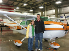
Michelle and I had planned to fly to San Diego on December 13th and to Tehachapi on the 14th, but the weather ruined both of those flights. We were hit with a major winter storm system on the 13th and couldn't fly anywhere and the system lingered in the mountains preventing us from flying to Tehachapi on the 14th. Instead, we decided to fly up the valley to Mammoth where I could get some more high altitude practice taking offs and landings.
Flying to Mammoth also was a good opportunity to test my new configuration for recording the flight. I ordered a ground loop isolator which is just a special cord that was supposed to get rid of the alternator noise in the audio, I modified the camcorder mount, and I bought a digital voice recorder so I could have independent audio of the intercom and the cockpit. I also bought a SPOT messenger to track our flights as safety equipment and this was it's first flight as well.
It was a very scenic flight on the way up with the mountains covered with snow, although there was continuous light turbulence, which just got annoying. I didn't leave the video on the entire flight this time, but instead turned it on once and a while to get different scenery and angles. I really liked how some of the side shots turned out.
Unfortunately, even though I got slightly less dash in the view, there was still more than I had hoped for and the angle was low such that I was usually recording below the horizon. The intercom audio still has alternator noise on it, the cabin noise was worse than expected, and I still have the propeller flying off the screen even though I played with the different frame rates. I still have some work to do when editing it to see if I can improve it at all.
Back to the flight itself, the pattern at Mammoth is pretty interesting. There are tall mountains to the south and a smaller ridge to the north. The winds were 10 gusting to 15 knots from the south-west so I flew the right hand pattern around the smaller ridge to runway 27. I thought that I would always maintain sight of the airport, but I soon found out that as I started my descent on downwind, I quickly lost sight of the airport. It's not until your turning final until you see the runway appear from behind the ridge. This caused me some trouble, but I didn't have my approach fully stabilized since i didn't know where the runway was and I couldn't use my standard power settings because of the higher altitude. I ended up being high and fast on the first approach and floated a long ways down the runway. The second time around, I ended up being short and needed significant power to get back on the glide slope by the time I saw the runway. Long story short, I wouldn't feel bad about doing a straight in approach to the uncontrolled airport in the future.
After two time around the pattern, we decided we better head back to Bishop for lunch since we were both getting hungry. After my 3rd not so wonderful landing of the day, we walked into the lobby of the Bishop airport to find that the restaurant was out of business! The airport is also too far from town for us to walk. Fortunately they had a snackbar there and I was rummaging through that until a lady came in looking for the fuel attendant (who was out to lunch at the time). She was very nice and offered us a ride into town and back for lunch since she would have to come back to see the fuel guy after his lunch. She dropped us off at a very good Mexican restaurant named something Amigos and we were able to catch the bus back to the airport (she had thought it wasn't running).
After lunch we headed back to Inyokern where I made one of the nicest landings in several months. Once I finish editing the video from this flight, I'll post the link here. The SPOT messenger worked pretty good, but I'm still not sure what to think about it. On the way there, there was a 100 mile gap in the tracking from Owen's Lake all the way up to Mammoth, although it did have very good tracking the whole way back. It's absolutely better than nothing, but I really wish it didn't have those gaps. I guess more time is needed to tell how reliable it really is.
Showing posts with label density altitude. Show all posts
Showing posts with label density altitude. Show all posts
Thursday, December 18, 2008

Tuesday, November 11, 2008
Flight to the elusive Big Bear, L35
Michelle and I have been trying to fly to Big Bear forever. Once I bought my Skylane, I felt more comfortable flying into high altitude airports. We tried flying down several times with N951CC, but didn't make it until today. Previous attempts were foiled by weather of course, fuel pumps inop at IYK, Michelle started feeling sick half way there, some others I don't remember, then I cancelled a trip with some friends to go there on Saturday due to an airmet for turbulence.
I want to fly into Big Bear for 2 reasons. The first reason is just to go there since it seems like a really neat place. The second reason is to tackle a high altitude airport. The airport is at 6,752 feet and has a single runway that is 5,850 feet long. Density altitudes can go above 10,000 feet in the summer, but shouldn't be too bad today. I want to go and visit my Uncle in Utah, but he lives in the high terrain so this will give me the confidence in my and the airplanes ability to land at high altitude airports. I also want to become more comfortable in higher terrain since I want to take a route through Colorado some year flying back to WI. This airport is a good practice airport and today I finally get my chance.
Today the winds were calm here, across the desert, and at Big Bear and forcasted to stay that way. There were very few clouds even visible in the sky but they were 20k or higher and hundreds of miles away. There were no airmets, sigmets, TFRs, or adverse conditions. There was only 1 notam and that was for the unmanned vehicle west of Victorville that has been there for the last year and a half. Long story short, it couldn't have been a nicer day. I had plenty of gas to get to Big Bear, but assuming their gas would be expensive way up there, I added some fuel (15 gallons) so I could make the round trip without more gas.
The air was cool and the flight was smooth as glass; I really love flying in the winter. As we passed over Hesparia I was looking at the map and the GPS and trying to compare to the mountain ridges I was seeing in front of me. I couldn't tell if I was supposed to fly around the near set of ridges or right over them. I decided to peek around them and found that I should have gone right over. Not a big deal, we just added 2 minutes to the flight time, but we did get a better view of the ski area.


The winds were light out of the east and the traffic was using runway 8, which is right traffic. I flew east to the south of the airport and descended to the pattern altitude of 8,000 feet. It didn't take long to descend only 1,500 feet from cruising altitude to pattern altitude! I swung around and entered a 45 degree right downwind for runway 8 once conflicting traffic had me in sight and gave me the right away. The were further behind and slower so I was able to cut ahead of them with no problem.

I knew that I would need higher power settings for flying the pattern and landing, but I didn't know how much more. I usually use 2000 RPM in the pattern and 1500 RPM on the descent to land (with low power settings and the RPM at the high-speed stops, it's just like a fixed pitch prop and I use power to control the RPM). I found myself using more and more power to maintain level flight and 80 kts. I ended up around 2300 RPM. I extended the downwind a bit so I'd have more time to play with my descent on final. I set the RPM to 1800 and started down. I soon realized this was way more than I needed and I was very high on the approach. No problem, I put in full flaps and that put me on a perfect path to landing. The landing was just fine, but I did drift just a little.

As Michelle and I were walking towards the pilot lounge and restaurant, I noticed they had fuel at $3.50 per gallon!!!!! I just paid $5.19 at IYK expecting it to be more here, stupid me for adding gas before the flight. After we ate, I pulled the airplane over to the pumps and filled it to the brim with 35.9 more gallons, this saved me $60.67 over buying that gas at IYK.
It was pretty cool up at 6,750 feet, but I was comfortable in a sweatshirt. Regardless, the restaurant had indoor seating with big glass panel windows to see the ramp and the airplane traffic. I thought the food was very good, I had a bacon cheeseburger and a side salad. Michelle thought hers was only OK, she had strawberry crepes, but she thought they were too drenched in sauce. She was expecting them to be too drenched and wanted to order the apple cinnamon ones instead, but they were all out. I guess we'll have to go back for the apple cinnamon ones someday! They even gave us a coupon to come back.
On the flight back, we continued east instead of returning to the west and the high terrain quickly fell off. The approach to Big Bear is definitely easier from the east, but not too difficult from the west. It took us a few miles before I could establish communications with Riverside Radio to open my flight plan and LA Center for flight following. I lost contact with LA center before they handed me off and other traffic had to relay the hand-off. We were approved through Edwards restricted airspace above 6.000 feet on the way back and were home quickly.
Michelle had a very weird episode just as we were landing back at IYK. Just as I was turning to a 45 to enter downwind, she started screaming in pain. I didn't know if it was a pressurization thing and I should climb back up or if she needed to get down right away. I couldn't tell what was going on and she was just shaking her head so I kept on and flew a normal landing pattern. She was fine after we landed and she described it as if her tooth was about to explode. This weird though since I've heard of air pockets in teeth causing problems as you climb, but never as you land; weird. I logged 2.1 hours and finally our flight to Big Bear and back. Now I'm confident in our ability to take on the next high altitude airport, Panguitch, UT to visit my Uncle Errol. The Panguitch airport (U55) is almost exactly the same elevation and runway length as Big Bear so that should be no more difficult than today.
More pictures from this flight can be seen here.
I want to fly into Big Bear for 2 reasons. The first reason is just to go there since it seems like a really neat place. The second reason is to tackle a high altitude airport. The airport is at 6,752 feet and has a single runway that is 5,850 feet long. Density altitudes can go above 10,000 feet in the summer, but shouldn't be too bad today. I want to go and visit my Uncle in Utah, but he lives in the high terrain so this will give me the confidence in my and the airplanes ability to land at high altitude airports. I also want to become more comfortable in higher terrain since I want to take a route through Colorado some year flying back to WI. This airport is a good practice airport and today I finally get my chance.
Today the winds were calm here, across the desert, and at Big Bear and forcasted to stay that way. There were very few clouds even visible in the sky but they were 20k or higher and hundreds of miles away. There were no airmets, sigmets, TFRs, or adverse conditions. There was only 1 notam and that was for the unmanned vehicle west of Victorville that has been there for the last year and a half. Long story short, it couldn't have been a nicer day. I had plenty of gas to get to Big Bear, but assuming their gas would be expensive way up there, I added some fuel (15 gallons) so I could make the round trip without more gas.
The air was cool and the flight was smooth as glass; I really love flying in the winter. As we passed over Hesparia I was looking at the map and the GPS and trying to compare to the mountain ridges I was seeing in front of me. I couldn't tell if I was supposed to fly around the near set of ridges or right over them. I decided to peek around them and found that I should have gone right over. Not a big deal, we just added 2 minutes to the flight time, but we did get a better view of the ski area.

Mugshot

Lake Arrowhead

Ski runs
The winds were light out of the east and the traffic was using runway 8, which is right traffic. I flew east to the south of the airport and descended to the pattern altitude of 8,000 feet. It didn't take long to descend only 1,500 feet from cruising altitude to pattern altitude! I swung around and entered a 45 degree right downwind for runway 8 once conflicting traffic had me in sight and gave me the right away. The were further behind and slower so I was able to cut ahead of them with no problem.

45 to enter right downwind
I knew that I would need higher power settings for flying the pattern and landing, but I didn't know how much more. I usually use 2000 RPM in the pattern and 1500 RPM on the descent to land (with low power settings and the RPM at the high-speed stops, it's just like a fixed pitch prop and I use power to control the RPM). I found myself using more and more power to maintain level flight and 80 kts. I ended up around 2300 RPM. I extended the downwind a bit so I'd have more time to play with my descent on final. I set the RPM to 1800 and started down. I soon realized this was way more than I needed and I was very high on the approach. No problem, I put in full flaps and that put me on a perfect path to landing. The landing was just fine, but I did drift just a little.

A little high, but under control
As Michelle and I were walking towards the pilot lounge and restaurant, I noticed they had fuel at $3.50 per gallon!!!!! I just paid $5.19 at IYK expecting it to be more here, stupid me for adding gas before the flight. After we ate, I pulled the airplane over to the pumps and filled it to the brim with 35.9 more gallons, this saved me $60.67 over buying that gas at IYK.
It was pretty cool up at 6,750 feet, but I was comfortable in a sweatshirt. Regardless, the restaurant had indoor seating with big glass panel windows to see the ramp and the airplane traffic. I thought the food was very good, I had a bacon cheeseburger and a side salad. Michelle thought hers was only OK, she had strawberry crepes, but she thought they were too drenched in sauce. She was expecting them to be too drenched and wanted to order the apple cinnamon ones instead, but they were all out. I guess we'll have to go back for the apple cinnamon ones someday! They even gave us a coupon to come back.
On the flight back, we continued east instead of returning to the west and the high terrain quickly fell off. The approach to Big Bear is definitely easier from the east, but not too difficult from the west. It took us a few miles before I could establish communications with Riverside Radio to open my flight plan and LA Center for flight following. I lost contact with LA center before they handed me off and other traffic had to relay the hand-off. We were approved through Edwards restricted airspace above 6.000 feet on the way back and were home quickly.
Michelle had a very weird episode just as we were landing back at IYK. Just as I was turning to a 45 to enter downwind, she started screaming in pain. I didn't know if it was a pressurization thing and I should climb back up or if she needed to get down right away. I couldn't tell what was going on and she was just shaking her head so I kept on and flew a normal landing pattern. She was fine after we landed and she described it as if her tooth was about to explode. This weird though since I've heard of air pockets in teeth causing problems as you climb, but never as you land; weird. I logged 2.1 hours and finally our flight to Big Bear and back. Now I'm confident in our ability to take on the next high altitude airport, Panguitch, UT to visit my Uncle Errol. The Panguitch airport (U55) is almost exactly the same elevation and runway length as Big Bear so that should be no more difficult than today.
More pictures from this flight can be seen here.
Subscribe to:
Posts (Atom)