Wednesday, December 31, 2008

Scenic flight over Lake Powell and more, December 28th, 2008

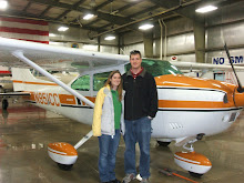
So the day finally came. Uncle Errol met us at the hotel early (before the sun was up) and we ate breakfast at their buffet. We sat and chatted for a while since it was still dark out and I was waiting for the temperature to warm up a bit. Eventually we headed out to the airport as the sun came up and we could see how clear the sky was. The weather was perfect on our entire route except for some turbulence up north, but we decided we wouldn't be flying that far anyways. The lineman brought my airplane out of the heated hanger as I called in to get my weather briefing and file my flight plan.

It was pretty frigid outside as I preflighted the airplane, but everything was in good shape. They REALLY topped off the tanks since fuel flowed out of the top of the tanks when I took the caps off to check the quantity. I quickly put the caps back on and wrote down "full" in the record book. I moved headsets around since Michelle would be in the back for this flight and explained everything I was doing for my Uncle. After the preflight I primed it really good and gave it a try. It started right up, but was a bit rough due to the cold weather. I let it warm up and just a bit faster than idle until for a few minutes, then let it truly warm up at 1200 RPM for another few minutes; I was able to get the cylinder head and oil temperatures into the green before takeoff.

We circled a few times over the airport to gain altitude before heading east near Cedar Breaks National Park, which was at about 10,000 ft. Once we cleared the high terrain, we descended down a bit for better sightseeing. We couldn't go down too far since Lake Powell is a National Recreation Area and I have to stay at least 2,000 ft above the rim of the canyon, which was around 5,000 ft. Still a ways out, we could see the smoke stacks from the power plant near Page. Errol said the environmentalists were very upset that they allowed the smoke stacks to be located there and I can see why. The smoke created a thin haze that extended quite a ways up the lake.

We turned south to overfly the dam and a little bit of Marble Canyon before turning back north over the dam again. I made sure to fly past the dam before turning back so I wouldn't be considered "loitering in the vicinity" of the dam, which is prohibited by the FAA. Then we continued north over the lake, then turned east and flew around the south side of Navajo Mountain. We kept flying east and while we were trying to find Monument Valley on the map (since it wasn't in my GPS) we eventually could see the features in the distance and just flew right towards them. Errol pointed out some of the different features including the mittens as we circled around them. It was very cool to see shadows rotate around the features as we flew, of course they weren't physically moving, but it appeared that way since we were moving past them.

Eventually we ended up on a northerly heading and I put the GPS waypoint I created for Natural Bridges National Monument straight ahead. On the way, we flew over the San Juan river that feed Lake Powell and we got to see it twist and turn as it made its way. As we approached Bridges, we could see the outline of the park on the map and compared the roads to what we saw in front of us and we could define the park. The hunt was on to see if we could actually find any bridges from the air. My uncle was keen to point out that whenever the road made a hook towards the edge, there was a lookout for a nearby bridge, so that's where we looked. Sure enough we eventually found a few bridges and I circled around so we could all see them and get good pictures.

After we were finished with Bridges, we headed to Bullfrog further north on Lake Powell. We flew over Halls Crossing and Bullfrog Basin airports since nobody was crossing their legs yet and headed south to the Rincon, which was formed when some of the walls collapsed cutting off the river forcing it to follow another path. Next we headed west towards the Escalante River. We flew west over the river and Errol was able to guide us to 2 more bridges. This area of the lake had several interesting features such as shear walls, large islands, canyons feeding the river, etc.

On our way back from the Escalante River, Errol showed us hole-in-the-rock, which is where the LDS blasted a ramp down to the Colorado River for their wagons to use. It is impossible to imagine a wagon going down such a steep trail and I guess it's more unbelievable when you're standing right there. Next we headed south-east back across the lake towards Navajo Mountain to see Rainbow Bridge. I circled back around to get another view at the natural bridge and for a better opportunity for pictures by putting it off the right side for Errol and Michelle.

After Rainbow Bridge we started heading for Page, but since everybody said they could keep holding their bladders, we turned west and started heading back instead. We flew right over Bryce Canyon, which seemed impressive, but not as much as what we had just seen. We were told it is better to see it from ground level. I can believe that since I know Zion itself is much more majestic from inside the slot canyons than it is from flying over. We also flew over Panguitch and Errol was able to find his house before we crossed the final pass and were headed back down to Cedar City. It was easy to see that it must have been warmer than freezing temperatures because the ice and snow still on the runway was beginning to melt and clear off. After almost exactly 4 hours of flying, I shutdown the airplane and the lineman put it back into the heated hanger for the night.

We were all hungry at this point so we headed to Denny's for lunch then back to the hotel. This was a good time for us to take a dip in the pool and relax for awhile after being up so early. We went to Applebee's for dinner and watched part of the San Diego Charger's game before heading to bed for the night. I'm still excited about how well the flight went, how much we were able to see, and how smooth the air was.

Flight to Cedar City via Zion, December 27, 2008

I already posted about our flight to UT here, but now I've got a video to add.


Monday, December 29, 2008

You'll have to wait

Michelle and I made it home from our Utah trip and very exciting scenic tour of so many things.  I've been downloading movies and pictures to the computer for over an hour so you'll have to wait before I get anything organized and posted.

The scenic trip I had planned would be a bladder stretcher and would have taken us as far north as Moab and Arches, but would have missed Monument Valley.  The weather was forecasting turbulence to the north and my uncle had additional ideas of places to visit so we narrowed our trip.  We flew over Paria Canyon, Page, the dam, Lake Powell, Navajo mountain, Monument Valley, Bridges (yes we saw some from the air), San Juan river, Escalante river, hole-in-the-wall, Rainbow bridge, Bryce Canyon, and Panguitch.

On the flight back to CA we flew back to page and over the dam and also saw Marble Canyon, the Grand Canyon, the skywalk (U shaped walk that hangs over the edge of the canyon), Lake Mead, Hoover dam, and Las Vegas.

All of the flights were incredibly smooth and enjoyable, definitely brings out the reason I love to fly.

Saturday, December 27, 2008

We made it to UT!

Michelle and I have been anticipating our trip to UT for a while now and we finally made it. We had to cancel last week due to weather and we almost had to cancel this week, but we shifted the trip a day instead to be Sat, Sun, Mon instead of Fri, Sat, Sun.

The air temperature at Inyokern was about 28 degrees so I really would have liked a preheat, but we don't have those services available. I've been trying to get into a hanger since I got the airplane, but the manager still hasn't worked anything out for me. I'm not sure if it helps at all, but the morning sun was shining under the shade hanger and directly on the nose of the airplane, I'll never know if this lessened the crime. I backed the airplane out to get some sun on the tail to get rid of the trace frost on the elevator, which was gone quickly.

The flight was absolutely wonderful, this is what flying is all about!!! The heater worked just fine to keep us comfortable, but the cool air made for an extremely smooth flight. The snow covering the landscape made it even more scenic. I was cleared through China Lake and Echo restricted airspaces and we headed right for Vegas. Unfortunately, we didn't get to directly overfly Vegas and Lake Mead since we'd interfere with the Las Vegas airline traffic.

The scenery got incredibly better the further we got into Utah. We overflew Zion and circled around getting some pretty good video. It was difficult to find slot canyons that Zion is such famously known for. After flying around Zion, we descended and headed towards Cedar City. The winds were calm so we entered a right downwind for right traffic for runway 20, the calm wind runway. As we were flying parallel to the runway, I called and asked for the conditions of the runway, which were reported as pretty clear and dry. The runway looked pretty patchy with snow and ice, but the landing was uneventful and I rolled without using brakes until I slowed down and wouldn't have to worry about skidding or sliding.

The local FBO had some space available and I was able to put it into their heated hanger. This will eliminate the need for a preheat and prevent frost from forming on the airframe. My Uncle Errol met us at the airport and took us to check into our hotel room. We got some quick lunch then went back to go over the plan for tomorrow where we're going to do a scenic overflight of Lake Powell and several surrounding National Parks. Errol's daughter Kimberly invited us over to dinner and we enjoyed an excellent spaghetti dinner where we met her daughter Tarren (sp?).

Here's a picture of the four of us at Kimberly's house. I'll post again once I have the videos downloaded.

Tuesday, December 23, 2008

3D Ultrasound

Michelle and I decided to get a 3D ultrasound done because it seems very interesting. Our friends just had one done for their twins and it was really neat. The other lady in our class also had one done for their first child and shared it with us during the class. Michelle looked into them and there are a few in our area (within 3 hours driving time). She decided on Glendale since they have the best deal. This is not a medically significant ultrasound and it seems more obvious when they offer xmas deals! I don't remember real medical procedures having holiday specials... In fact, our insurance will not cover the exam since it is optional and not medically significant, but the "deal" is for only $100 so we decided to do it and we'll pay out of pocket. Depending on when we get home tomorrow night, I'll either post the video and pictures tomorrow or xmas day.

On the way down there, we also plan on doing to shopping since we don't get many opportunities. We are planning on stopping by Linens N Things to use our gift card before they go out of business. We also will stop by some furniture stores to look for rocker/recliners for Michelle. The trip also gives us an opportunity to eat at a good (normal for those who aren't deprived) restaurant. We've never eaten at a Claim Jumpers and we now have one in Palmdale so we might try that, but they also have Famous Daves and since we won't be in Brookfield this xmas I will be missing my opportunity there. Unfortunately, the weather and recliner will mean we will have to drive instead of fly, and we'll have to leave the dogs outside in the cold all day, but we're excited to see our little girl's face!


Sunday, December 21, 2008

N951CC flight to Mojave, December 20th 2008

Since we didn't get to fly to Tehachapi last week for the anniversary of our engagement, we decided to try again. This time instead of the winter storm preventing us from getting there, there were some clouds in the valley, but worse there were notices to airmen for ice and 6 inches of snow on the airport. We decided to Rosemond instead, we went there a while ago and they had a great buffet.

Rosemond doesn't have any wind information so I got my wind information from the nearby Mojave airport light out of the east (070@4). Since Rosemond prefers runway 25 in light winds to avoid overflying the nearby houses, I decided to land runway 25 (with the wind). After turning to final I noticed that even though my airspeed was right at my normal approach speed I was significantly faster over the ground than expected. I was able to compensate, but it wasn't the prettiest landing, I should probably intentially practice these. They are not standard landings and are rarely done, but sometimes a downwind landing is safer due to terrain (such as Kernville).

Unfortunately the restaurant wasn't open, they changed their hours to open at 4pm instead of 11am except for Sundays. Great now the last two restaurants we've gone to have been closed, next time I should check! We decided to fly back to Mojave since we've been there more recently and it's a very short flight on the way home. Mojave was open, but they were extremely slow since Scaled composites (Burt Rutan's company) had brought a large party in (we didn't see Burt or Dick). There was only 1 waitress and she was very overworked. The food was excellent as usually and I filled up with cheap gas before we took back off for home.

On the way home, I decided to try to find Kelso valley. Our neighbor lent me a book about flying around here in the olden days. It's a very intersting book to read. A woman wrote the book about her and flying adventures with her husband who flew into all sorts of crazy places; mostly dried lakes and old dirt roads. One of the locations they flew into was Kelso valley and I think I knew where it was. I looked on Google Earth and I think I could see a desert scar from a runway decades ago.

The air was extremely smooth so we flew low over the mountains and I believe I found the right valley. It was easily wide enough to descend down into and land. There were a few homesteads scattered around, but I didn't see the runway. I think it was buried in the snow. After flying over this valley, we cut back over to the Owen's valley and flew back to Inyokern.

Friday, December 19, 2008

Maverick and Emmett playing in the snow December 16th, 2008

This past week we've been having winter stormy weather, but unfortunately we haven't gotten any snow in the city.  Since we wanted to go to the snow and let the dogs play, we got home from work a little early on Tuesday and drove up to Walker's Pass.  It's about a half hour drive from our house and there is a little camping area there where you can pull off the road and let the dogs play.  Here is a video from the trip.