
Overview of the trail

Top down view


View from Trail Camp including some of the switchbacks, which was just to the south (left) of the lake.

View of Mt. Whitney from Trail Camp.


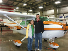
This is my first blog and I'm going to use it to journal the trips Michelle and I (and sometimes the dogs) take in our 1979 Cessna Skylane 182Q. I also post other stuff we do such as hiking and home improvements, but those aren't as interesting.
Top down view
View of Mt. Whitney from Trail Camp.


No comments:
Post a Comment