Showing posts with label GPS. Show all posts
Showing posts with label GPS. Show all posts
Thursday, December 11, 2008
SPOT tracking
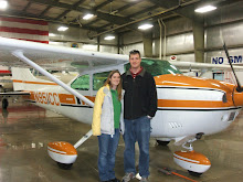
I just created a link so that anybody can track our progress with the SPOT messenger. This will usually be us flying around, but could be hiking, driving, or just exploring. People can use this to see when we're getting close to arriving if we're stopping by to visit, to track our adventures, or to see that we got home safely. The link is a new gadget to the left of this page, just click on the link and it should take you to a new page to track our progress.
Friday, October 3, 2008
Whitney GPS tracks
I just wrote about Kevin and I hiking Mt. Whitney. Kevin was nice enough to carry his GPS up there so I didn't have to carry mine. I have a Garmin 296 portable aviation GPS that is much bigger than Kevin's hiking Garmin etrex legend GPS. Unfortunately, the GPS lost track a lot due to having limited sky exposure at points. Some places had rock cliffs all around which made the GPS lose signal, but if you piece all the tracks together, it provides a pretty good track of the hike. There are a few spots that jump off the trail and I think those are from when the GPS got it's signal back, but the accuracy was still low. Here are some picks of the hike using Google Earth.


Overview of the trail

Top down view


View from Trail Camp including some of the switchbacks, which was just to the south (left) of the lake.

View of Mt. Whitney from Trail Camp.


Friday, June 6, 2008
Hiking Owen's Peak
Originally, Michelle and I were thinking about flying to the Grand Canyon to go camping for the weekend. I only looked at a few ideas before I saw the forecast for strong winds. We cancelled the trip because of the winds and hiked Owen's Peak instead. We'll probably still do the Grand Canyon trip since it seemed very welcoming. They are dog friendly and allow dogs at the campground an on the trails. They only prohibit dogs below the rim of the canyon, but they have a kennel to drop your dogs off for a few hours if you want to hike down.


I decided to bring my GPS this time to track our hike and get a final decision on how long of a hike it is. The GPS worked well, but I don't think we have an answer yet. Every time it lost track for a few feet it started a new track and it would sometimes had re-initialize errors, so the track isn't completely accurate. The entire trip down is accurate, but that track starts before we get to the top so there is some overlap. With this GPS data, I'm putting the trail at 5.4 miles, but the sign says 4.4 miles.
This is an extremely difficult trail to follow. The trail seems to split in several places and seems to disappear in others. If you get off the track, you'll be hiking some pretty nasty terrain, trust me, I know... I did find a wrecked airplane up there on one of my excursions though! I was hoping the GPS track could be somehow useful to other hikers for their first time up. I'm not really sure what to do with the track to make it useful though. If I ever figure out a good way to present the info, I'll be sure to post it.
I took a lot of pictures of the flowers this time, the complete set of pictures from this hike are in my photo album here.
We also came across a snake that we haven't yet identified. Emmett our stupid German Shorthair walked right over him and when I stopped when I saw it, he came back and stepped right over it again. The snake never moved so I thought it might have been dead, but as I walked by, it was flicking it's tongue out and it's eyes were open.
The trip took us 6 hours this time, which is longer than normal. The hike seemed harder than normal too with more loose sandy trail needing extra caution. Even the dogs had a hard time, both of them wore their pads down pretty badly, but Maverick our Weimaraner tore two of his pads, one looks like a torn blister, the other is slit pretty deep. He hasn't had good luck hiking lately, last time he cut his ear really badly jumping through a barbed wire fence.
The ruling has come back that this snake was a Pacific Gopher snake, which a rattlesnake look alike, but is not poisonous.
Since we didn't get out flying today, we'll probably head somewhere tomorrow, but maybe just for a day trip.
Subscribe to:
Posts (Atom)