I already posted about our flight to UT here, but now I've got a video to add.
Showing posts with label 182. Show all posts
Showing posts with label 182. Show all posts
Wednesday, December 31, 2008
Monday, December 29, 2008
You'll have to wait
Michelle and I made it home from our Utah trip and very exciting scenic tour of so many things. I've been downloading movies and pictures to the computer for over an hour so you'll have to wait before I get anything organized and posted.

The scenic trip I had planned would be a bladder stretcher and would have taken us as far north as Moab and Arches, but would have missed Monument Valley. The weather was forecasting turbulence to the north and my uncle had additional ideas of places to visit so we narrowed our trip. We flew over Paria Canyon, Page, the dam, Lake Powell, Navajo mountain, Monument Valley, Bridges (yes we saw some from the air), San Juan river, Escalante river, hole-in-the-wall, Rainbow bridge, Bryce Canyon, and Panguitch.
On the flight back to CA we flew back to page and over the dam and also saw Marble Canyon, the Grand Canyon, the skywalk (U shaped walk that hangs over the edge of the canyon), Lake Mead, Hoover dam, and Las Vegas.
All of the flights were incredibly smooth and enjoyable, definitely brings out the reason I love to fly.
Saturday, December 27, 2008
We made it to UT!
Michelle and I have been anticipating our trip to UT for a while now and we finally made it. We had to cancel last week due to weather and we almost had to cancel this week, but we shifted the trip a day instead to be Sat, Sun, Mon instead of Fri, Sat, Sun.
The air temperature at Inyokern was about 28 degrees so I really would have liked a preheat, but we don't have those services available. I've been trying to get into a hanger since I got the airplane, but the manager still hasn't worked anything out for me. I'm not sure if it helps at all, but the morning sun was shining under the shade hanger and directly on the nose of the airplane, I'll never know if this lessened the crime. I backed the airplane out to get some sun on the tail to get rid of the trace frost on the elevator, which was gone quickly.
The flight was absolutely wonderful, this is what flying is all about!!! The heater worked just fine to keep us comfortable, but the cool air made for an extremely smooth flight. The snow covering the landscape made it even more scenic. I was cleared through China Lake and Echo restricted airspaces and we headed right for Vegas. Unfortunately, we didn't get to directly overfly Vegas and Lake Mead since we'd interfere with the Las Vegas airline traffic.
The scenery got incredibly better the further we got into Utah. We overflew Zion and circled around getting some pretty good video. It was difficult to find slot canyons that Zion is such famously known for. After flying around Zion, we descended and headed towards Cedar City. The winds were calm so we entered a right downwind for right traffic for runway 20, the calm wind runway. As we were flying parallel to the runway, I called and asked for the conditions of the runway, which were reported as pretty clear and dry. The runway looked pretty patchy with snow and ice, but the landing was uneventful and I rolled without using brakes until I slowed down and wouldn't have to worry about skidding or sliding.
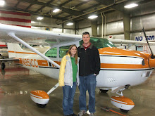
The local FBO had some space available and I was able to put it into their heated hanger. This will eliminate the need for a preheat and prevent frost from forming on the airframe. My Uncle Errol met us at the airport and took us to check into our hotel room. We got some quick lunch then went back to go over the plan for tomorrow where we're going to do a scenic overflight of Lake Powell and several surrounding National Parks. Errol's daughter Kimberly invited us over to dinner and we enjoyed an excellent spaghetti dinner where we met her daughter Tarren (sp?).
Here's a picture of the four of us at Kimberly's house. I'll post again once I have the videos downloaded.

The air temperature at Inyokern was about 28 degrees so I really would have liked a preheat, but we don't have those services available. I've been trying to get into a hanger since I got the airplane, but the manager still hasn't worked anything out for me. I'm not sure if it helps at all, but the morning sun was shining under the shade hanger and directly on the nose of the airplane, I'll never know if this lessened the crime. I backed the airplane out to get some sun on the tail to get rid of the trace frost on the elevator, which was gone quickly.
The flight was absolutely wonderful, this is what flying is all about!!! The heater worked just fine to keep us comfortable, but the cool air made for an extremely smooth flight. The snow covering the landscape made it even more scenic. I was cleared through China Lake and Echo restricted airspaces and we headed right for Vegas. Unfortunately, we didn't get to directly overfly Vegas and Lake Mead since we'd interfere with the Las Vegas airline traffic.
The scenery got incredibly better the further we got into Utah. We overflew Zion and circled around getting some pretty good video. It was difficult to find slot canyons that Zion is such famously known for. After flying around Zion, we descended and headed towards Cedar City. The winds were calm so we entered a right downwind for right traffic for runway 20, the calm wind runway. As we were flying parallel to the runway, I called and asked for the conditions of the runway, which were reported as pretty clear and dry. The runway looked pretty patchy with snow and ice, but the landing was uneventful and I rolled without using brakes until I slowed down and wouldn't have to worry about skidding or sliding.
The local FBO had some space available and I was able to put it into their heated hanger. This will eliminate the need for a preheat and prevent frost from forming on the airframe. My Uncle Errol met us at the airport and took us to check into our hotel room. We got some quick lunch then went back to go over the plan for tomorrow where we're going to do a scenic overflight of Lake Powell and several surrounding National Parks. Errol's daughter Kimberly invited us over to dinner and we enjoyed an excellent spaghetti dinner where we met her daughter Tarren (sp?).
Here's a picture of the four of us at Kimberly's house. I'll post again once I have the videos downloaded.

Sunday, December 21, 2008
N951CC flight to Mojave, December 20th 2008
Since we didn't get to fly to Tehachapi last week for the anniversary of our engagement, we decided to try again. This time instead of the winter storm preventing us from getting there, there were some clouds in the valley, but worse there were notices to airmen for ice and 6 inches of snow on the airport. We decided to Rosemond instead, we went there a while ago and they had a great buffet.
Rosemond doesn't have any wind information so I got my wind information from the nearby Mojave airport light out of the east (070@4). Since Rosemond prefers runway 25 in light winds to avoid overflying the nearby houses, I decided to land runway 25 (with the wind). After turning to final I noticed that even though my airspeed was right at my normal approach speed I was significantly faster over the ground than expected. I was able to compensate, but it wasn't the prettiest landing, I should probably intentially practice these. They are not standard landings and are rarely done, but sometimes a downwind landing is safer due to terrain (such as Kernville).
Unfortunately the restaurant wasn't open, they changed their hours to open at 4pm instead of 11am except for Sundays. Great now the last two restaurants we've gone to have been closed, next time I should check! We decided to fly back to Mojave since we've been there more recently and it's a very short flight on the way home. Mojave was open, but they were extremely slow since Scaled composites (Burt Rutan's company) had brought a large party in (we didn't see Burt or Dick). There was only 1 waitress and she was very overworked. The food was excellent as usually and I filled up with cheap gas before we took back off for home.
On the way home, I decided to try to find Kelso valley. Our neighbor lent me a book about flying around here in the olden days. It's a very intersting book to read. A woman wrote the book about her and flying adventures with her husband who flew into all sorts of crazy places; mostly dried lakes and old dirt roads. One of the locations they flew into was Kelso valley and I think I knew where it was. I looked on Google Earth and I think I could see a desert scar from a runway decades ago.
The air was extremely smooth so we flew low over the mountains and I believe I found the right valley. It was easily wide enough to descend down into and land. There were a few homesteads scattered around, but I didn't see the runway. I think it was buried in the snow. After flying over this valley, we cut back over to the Owen's valley and flew back to Inyokern.
Thursday, December 18, 2008
Flying to Mammoth, CA
Michelle and I had planned to fly to San Diego on December 13th and to Tehachapi on the 14th, but the weather ruined both of those flights. We were hit with a major winter storm system on the 13th and couldn't fly anywhere and the system lingered in the mountains preventing us from flying to Tehachapi on the 14th. Instead, we decided to fly up the valley to Mammoth where I could get some more high altitude practice taking offs and landings.
Flying to Mammoth also was a good opportunity to test my new configuration for recording the flight. I ordered a ground loop isolator which is just a special cord that was supposed to get rid of the alternator noise in the audio, I modified the camcorder mount, and I bought a digital voice recorder so I could have independent audio of the intercom and the cockpit. I also bought a SPOT messenger to track our flights as safety equipment and this was it's first flight as well.
It was a very scenic flight on the way up with the mountains covered with snow, although there was continuous light turbulence, which just got annoying. I didn't leave the video on the entire flight this time, but instead turned it on once and a while to get different scenery and angles. I really liked how some of the side shots turned out.
Unfortunately, even though I got slightly less dash in the view, there was still more than I had hoped for and the angle was low such that I was usually recording below the horizon. The intercom audio still has alternator noise on it, the cabin noise was worse than expected, and I still have the propeller flying off the screen even though I played with the different frame rates. I still have some work to do when editing it to see if I can improve it at all.
Back to the flight itself, the pattern at Mammoth is pretty interesting. There are tall mountains to the south and a smaller ridge to the north. The winds were 10 gusting to 15 knots from the south-west so I flew the right hand pattern around the smaller ridge to runway 27. I thought that I would always maintain sight of the airport, but I soon found out that as I started my descent on downwind, I quickly lost sight of the airport. It's not until your turning final until you see the runway appear from behind the ridge. This caused me some trouble, but I didn't have my approach fully stabilized since i didn't know where the runway was and I couldn't use my standard power settings because of the higher altitude. I ended up being high and fast on the first approach and floated a long ways down the runway. The second time around, I ended up being short and needed significant power to get back on the glide slope by the time I saw the runway. Long story short, I wouldn't feel bad about doing a straight in approach to the uncontrolled airport in the future.
After two time around the pattern, we decided we better head back to Bishop for lunch since we were both getting hungry. After my 3rd not so wonderful landing of the day, we walked into the lobby of the Bishop airport to find that the restaurant was out of business! The airport is also too far from town for us to walk. Fortunately they had a snackbar there and I was rummaging through that until a lady came in looking for the fuel attendant (who was out to lunch at the time). She was very nice and offered us a ride into town and back for lunch since she would have to come back to see the fuel guy after his lunch. She dropped us off at a very good Mexican restaurant named something Amigos and we were able to catch the bus back to the airport (she had thought it wasn't running).
After lunch we headed back to Inyokern where I made one of the nicest landings in several months. Once I finish editing the video from this flight, I'll post the link here. The SPOT messenger worked pretty good, but I'm still not sure what to think about it. On the way there, there was a 100 mile gap in the tracking from Owen's Lake all the way up to Mammoth, although it did have very good tracking the whole way back. It's absolutely better than nothing, but I really wish it didn't have those gaps. I guess more time is needed to tell how reliable it really is.
Saturday, November 22, 2008
Test flight with our new camcorder
For the past few years I've been watching videos on YouTube of people flying into different areas and capturing their adventures. I've been jealous and wanted to buy a camcorder to tape my own flights, but haven't been willing to spend the money. Michelle and I decided long ago that we would wait until we start our family before we buy a camcorder.
Here is a link to another pilot who posts his flights. This is his flight into Kernville, I figured I'd link this one since this it compares to the flight we just made.
Now that we have a girl on the way, we made the purchase. Granted she's not due until the end of February, but that's just too long to wait. It kind of goes along the lines of getting the new TV in time for the football season and the new camera in time for a long anticipated trip. The anticipated trip is to Panguitch, UT to visit my Uncle Errol and to fly over Lake Powell, the Grand Canyon, Lake Mead, Hoover Dam, and Las Vegas.
We decided that since we have a fancy new HD TV, we wanted to get a nice HD camcorder. We also want it to be digital since we will be posting both flights and videos of our daughter on the web for friends and family to see. The hassle of DV tapes eliminated that category, and since hard drives don't operate at altitude, those versions wouldn't work either. Hard drives rely on airflow between the disks so that the head "flies" between the platters. When the altitude goes up, the pressure goes down, and the head crashes and the disk fails.
This left us looking for a solid state HD camcorder. I also had 2 requirements for flying, an image stabilizer and a microphone input. All the HD camcorders come with image stabilization so that wasn't a problem, but finding one with external audio in was. Canon is really the only manufacturer supporting external audio anymore these days and we ended up with a Canon Vixia HF100.
My airplane just got out of maintenance so I was anxious to get back up and flying so a flight for lunch in Kernville to test the new camcorder setup was perfect. We also decided to take the dogs with us. They've each flown before, but this was the first time they both flew together and Michelle wasn't in back to calm them down.
The dogs did ok, but they both ended up being nervous at some point. Emmett was much worse off, but I think he'll get used to it. He's always not been a fan of bouncing around. When we drive up to trailheads to go hiking, he always lays down in the back of the Jeep, but he's never gotten sick.
The video turned out pretty good, but there are a few things I found that I want to change. I made a little stand the camcorder attaches to that has a sponge between as a shock absorber. I noticed that the sponge allowed the camera to shake more than if it was just attached firmly. The angle also didn't turn out too good, it was looking down too much and the dash takes almost 1/2 of the screen. This also causes issues since it tries to focus on the dash instead of outside. I also want to work on the audio a little. I have it tied into the co-pilot audio jack, but there seems to be a lot of noise in the audio.
I used a trial version of CyberLink PowerDirector to edit the video, but I think in the future, I'm going to try to use Microsoft Movie Maker so I don't have to pay for the software. I decided to shoot the trip in HD since I had more space on the card than the battery would last. The video was incredible when it was focusing on the terrain. After editing and down converting to HQ, the file was about 10 minutes and 652 Mb. Good thing YouTube just started allowing up to 1Gb uploads... It took about 1 hour to render the video on my PC and the clip is still trying to upload after almost an hour.
Tomorrow I'll be working on the attic since I spent all day playing...
Tuesday, November 11, 2008
Flight to the elusive Big Bear, L35
Michelle and I have been trying to fly to Big Bear forever. Once I bought my Skylane, I felt more comfortable flying into high altitude airports. We tried flying down several times with N951CC, but didn't make it until today. Previous attempts were foiled by weather of course, fuel pumps inop at IYK, Michelle started feeling sick half way there, some others I don't remember, then I cancelled a trip with some friends to go there on Saturday due to an airmet for turbulence.
I want to fly into Big Bear for 2 reasons. The first reason is just to go there since it seems like a really neat place. The second reason is to tackle a high altitude airport. The airport is at 6,752 feet and has a single runway that is 5,850 feet long. Density altitudes can go above 10,000 feet in the summer, but shouldn't be too bad today. I want to go and visit my Uncle in Utah, but he lives in the high terrain so this will give me the confidence in my and the airplanes ability to land at high altitude airports. I also want to become more comfortable in higher terrain since I want to take a route through Colorado some year flying back to WI. This airport is a good practice airport and today I finally get my chance.
Today the winds were calm here, across the desert, and at Big Bear and forcasted to stay that way. There were very few clouds even visible in the sky but they were 20k or higher and hundreds of miles away. There were no airmets, sigmets, TFRs, or adverse conditions. There was only 1 notam and that was for the unmanned vehicle west of Victorville that has been there for the last year and a half. Long story short, it couldn't have been a nicer day. I had plenty of gas to get to Big Bear, but assuming their gas would be expensive way up there, I added some fuel (15 gallons) so I could make the round trip without more gas.
The air was cool and the flight was smooth as glass; I really love flying in the winter. As we passed over Hesparia I was looking at the map and the GPS and trying to compare to the mountain ridges I was seeing in front of me. I couldn't tell if I was supposed to fly around the near set of ridges or right over them. I decided to peek around them and found that I should have gone right over. Not a big deal, we just added 2 minutes to the flight time, but we did get a better view of the ski area.


The winds were light out of the east and the traffic was using runway 8, which is right traffic. I flew east to the south of the airport and descended to the pattern altitude of 8,000 feet. It didn't take long to descend only 1,500 feet from cruising altitude to pattern altitude! I swung around and entered a 45 degree right downwind for runway 8 once conflicting traffic had me in sight and gave me the right away. The were further behind and slower so I was able to cut ahead of them with no problem.

I knew that I would need higher power settings for flying the pattern and landing, but I didn't know how much more. I usually use 2000 RPM in the pattern and 1500 RPM on the descent to land (with low power settings and the RPM at the high-speed stops, it's just like a fixed pitch prop and I use power to control the RPM). I found myself using more and more power to maintain level flight and 80 kts. I ended up around 2300 RPM. I extended the downwind a bit so I'd have more time to play with my descent on final. I set the RPM to 1800 and started down. I soon realized this was way more than I needed and I was very high on the approach. No problem, I put in full flaps and that put me on a perfect path to landing. The landing was just fine, but I did drift just a little.

As Michelle and I were walking towards the pilot lounge and restaurant, I noticed they had fuel at $3.50 per gallon!!!!! I just paid $5.19 at IYK expecting it to be more here, stupid me for adding gas before the flight. After we ate, I pulled the airplane over to the pumps and filled it to the brim with 35.9 more gallons, this saved me $60.67 over buying that gas at IYK.
It was pretty cool up at 6,750 feet, but I was comfortable in a sweatshirt. Regardless, the restaurant had indoor seating with big glass panel windows to see the ramp and the airplane traffic. I thought the food was very good, I had a bacon cheeseburger and a side salad. Michelle thought hers was only OK, she had strawberry crepes, but she thought they were too drenched in sauce. She was expecting them to be too drenched and wanted to order the apple cinnamon ones instead, but they were all out. I guess we'll have to go back for the apple cinnamon ones someday! They even gave us a coupon to come back.
On the flight back, we continued east instead of returning to the west and the high terrain quickly fell off. The approach to Big Bear is definitely easier from the east, but not too difficult from the west. It took us a few miles before I could establish communications with Riverside Radio to open my flight plan and LA Center for flight following. I lost contact with LA center before they handed me off and other traffic had to relay the hand-off. We were approved through Edwards restricted airspace above 6.000 feet on the way back and were home quickly.
Michelle had a very weird episode just as we were landing back at IYK. Just as I was turning to a 45 to enter downwind, she started screaming in pain. I didn't know if it was a pressurization thing and I should climb back up or if she needed to get down right away. I couldn't tell what was going on and she was just shaking her head so I kept on and flew a normal landing pattern. She was fine after we landed and she described it as if her tooth was about to explode. This weird though since I've heard of air pockets in teeth causing problems as you climb, but never as you land; weird. I logged 2.1 hours and finally our flight to Big Bear and back. Now I'm confident in our ability to take on the next high altitude airport, Panguitch, UT to visit my Uncle Errol. The Panguitch airport (U55) is almost exactly the same elevation and runway length as Big Bear so that should be no more difficult than today.
More pictures from this flight can be seen here.
I want to fly into Big Bear for 2 reasons. The first reason is just to go there since it seems like a really neat place. The second reason is to tackle a high altitude airport. The airport is at 6,752 feet and has a single runway that is 5,850 feet long. Density altitudes can go above 10,000 feet in the summer, but shouldn't be too bad today. I want to go and visit my Uncle in Utah, but he lives in the high terrain so this will give me the confidence in my and the airplanes ability to land at high altitude airports. I also want to become more comfortable in higher terrain since I want to take a route through Colorado some year flying back to WI. This airport is a good practice airport and today I finally get my chance.
Today the winds were calm here, across the desert, and at Big Bear and forcasted to stay that way. There were very few clouds even visible in the sky but they were 20k or higher and hundreds of miles away. There were no airmets, sigmets, TFRs, or adverse conditions. There was only 1 notam and that was for the unmanned vehicle west of Victorville that has been there for the last year and a half. Long story short, it couldn't have been a nicer day. I had plenty of gas to get to Big Bear, but assuming their gas would be expensive way up there, I added some fuel (15 gallons) so I could make the round trip without more gas.
The air was cool and the flight was smooth as glass; I really love flying in the winter. As we passed over Hesparia I was looking at the map and the GPS and trying to compare to the mountain ridges I was seeing in front of me. I couldn't tell if I was supposed to fly around the near set of ridges or right over them. I decided to peek around them and found that I should have gone right over. Not a big deal, we just added 2 minutes to the flight time, but we did get a better view of the ski area.

Mugshot

Lake Arrowhead

Ski runs
The winds were light out of the east and the traffic was using runway 8, which is right traffic. I flew east to the south of the airport and descended to the pattern altitude of 8,000 feet. It didn't take long to descend only 1,500 feet from cruising altitude to pattern altitude! I swung around and entered a 45 degree right downwind for runway 8 once conflicting traffic had me in sight and gave me the right away. The were further behind and slower so I was able to cut ahead of them with no problem.

45 to enter right downwind
I knew that I would need higher power settings for flying the pattern and landing, but I didn't know how much more. I usually use 2000 RPM in the pattern and 1500 RPM on the descent to land (with low power settings and the RPM at the high-speed stops, it's just like a fixed pitch prop and I use power to control the RPM). I found myself using more and more power to maintain level flight and 80 kts. I ended up around 2300 RPM. I extended the downwind a bit so I'd have more time to play with my descent on final. I set the RPM to 1800 and started down. I soon realized this was way more than I needed and I was very high on the approach. No problem, I put in full flaps and that put me on a perfect path to landing. The landing was just fine, but I did drift just a little.

A little high, but under control
As Michelle and I were walking towards the pilot lounge and restaurant, I noticed they had fuel at $3.50 per gallon!!!!! I just paid $5.19 at IYK expecting it to be more here, stupid me for adding gas before the flight. After we ate, I pulled the airplane over to the pumps and filled it to the brim with 35.9 more gallons, this saved me $60.67 over buying that gas at IYK.
It was pretty cool up at 6,750 feet, but I was comfortable in a sweatshirt. Regardless, the restaurant had indoor seating with big glass panel windows to see the ramp and the airplane traffic. I thought the food was very good, I had a bacon cheeseburger and a side salad. Michelle thought hers was only OK, she had strawberry crepes, but she thought they were too drenched in sauce. She was expecting them to be too drenched and wanted to order the apple cinnamon ones instead, but they were all out. I guess we'll have to go back for the apple cinnamon ones someday! They even gave us a coupon to come back.
On the flight back, we continued east instead of returning to the west and the high terrain quickly fell off. The approach to Big Bear is definitely easier from the east, but not too difficult from the west. It took us a few miles before I could establish communications with Riverside Radio to open my flight plan and LA Center for flight following. I lost contact with LA center before they handed me off and other traffic had to relay the hand-off. We were approved through Edwards restricted airspace above 6.000 feet on the way back and were home quickly.
Michelle had a very weird episode just as we were landing back at IYK. Just as I was turning to a 45 to enter downwind, she started screaming in pain. I didn't know if it was a pressurization thing and I should climb back up or if she needed to get down right away. I couldn't tell what was going on and she was just shaking her head so I kept on and flew a normal landing pattern. She was fine after we landed and she described it as if her tooth was about to explode. This weird though since I've heard of air pockets in teeth causing problems as you climb, but never as you land; weird. I logged 2.1 hours and finally our flight to Big Bear and back. Now I'm confident in our ability to take on the next high altitude airport, Panguitch, UT to visit my Uncle Errol. The Panguitch airport (U55) is almost exactly the same elevation and runway length as Big Bear so that should be no more difficult than today.
More pictures from this flight can be seen here.
Sunday, October 26, 2008
Furnace Creek Inn Brunch
Today Michelle and I flew to the Furnace Creek Inn for brunch. We flew south of the China Lake restricted airspace from Inyokern towards Trona and turned north over Trona between the China Lake R-2505 and Echo Range R-2524 restricted airspaces. Once we were north of the Echo range, we turned back east to cross the Panamint mountains into Death Valley. We turned north and flew up Death Valley over Badwater as we approached to land at the Furnace Airport L06. The was no wind and we landed runway 15 since the Mooney ahead of us had used that runway. There were cables to attach tie-downs to, but no tie-downs. I didn't have my tie-downs with me since I removed them for weight when we flew up to San Jose. I pulled the parking break, put the plugs and control lock in and called it good; we'd only be gone an hour and there was zero wind.


The airplane was still there safe and sound and there was still no wind. Michelle decided she wanted to head up the valley to take a look at Scotty's castle and the Ubehebe crater. We took off and headed north at 2500 feet to maintain 2000 ft over the national park. I called up Riverside Radio and asked if they were familiar with the Ubehebe crater or Scotty's castle for waypoints and they said they were not. She wanted to file me from Furnace Creek back to Inyokern, but I thought that would be dumb since we were flying 45 miles north of that route. I told her my route would be Furnace Creek L06, Stovepipe Wells L09, then up to Bishop BIH before heading south to Inyokern IYK. We weren't going to fly even close to that far north, but that put a line across where we would be flying in case something were to happen. That we at least they'd be looking in the right area. We circled around the sand dunes and airport at Stovepipe Wells and then continued north. We climbed up to 4500 ft as the valley floor started to climb to the north.

Obligatory mugshot


Telescope peak, I've climbed this 2 or 3 times.
Badwater
Furnace Creek Inn resort
Furnace Creek airport L09
The Mooney pilot already had called for the shuttle to the Inn so it arrived just as I finished securing the airplane. The Mooney folks were staying the week at the Furnace Creek ranch so the driver dropped them off first and then drove us up to the Inn, it was probably less than 5 minutes, but I'm glad we didn't walk it. There's only a gravel shoulder and it's uphill for about a mile. There was no wait for the brunch, which I guess is unusual, but the staff said this was because this is the first weekend they are open for the season and not everybody knows they are open again yet. The driver said they usually get between 12 to 40 pilots a weekend, today I was number 3.

The food was excellent and came with eggs to order, an entree on the menu, and the buffet. Michelle and I got omelettes that were way bigger than they needed to be, but they were very good. I ordered the french toast/pancakes/crepes (they were all mini) and Michelle ordered the Pasta Primavera. We also had fruit and too much desert from the buffet. Definitely a top notch brunch although it was a bit pricey at $21.95 per person. After brunch we walked around the resort a little before taking the shuttle back to the airport.

She really loved that dessert buffet
The airplane was still there safe and sound and there was still no wind. Michelle decided she wanted to head up the valley to take a look at Scotty's castle and the Ubehebe crater. We took off and headed north at 2500 feet to maintain 2000 ft over the national park. I called up Riverside Radio and asked if they were familiar with the Ubehebe crater or Scotty's castle for waypoints and they said they were not. She wanted to file me from Furnace Creek back to Inyokern, but I thought that would be dumb since we were flying 45 miles north of that route. I told her my route would be Furnace Creek L06, Stovepipe Wells L09, then up to Bishop BIH before heading south to Inyokern IYK. We weren't going to fly even close to that far north, but that put a line across where we would be flying in case something were to happen. That we at least they'd be looking in the right area. We circled around the sand dunes and airport at Stovepipe Wells and then continued north. We climbed up to 4500 ft as the valley floor started to climb to the north.

My altimeter is below zero!

Sand dunes near Stovepipe Wells
We circled around the crater once, which was very easy to find from the air then headed back east to fly over Scotty's castle. I climbed a bit more since they were nestled in the mountains a bit. After we left Scotty's, we climbed up to 10,500 ft and headed east through a pass and flew over Saline Valley on our way to Owen's Lake. I couldn't reach Joshua approach until we reached Owen's Valley even though we were pretty high. They responded near Lone Pine and I got flight following back to IYK. On our way down the valley, we could clearly see Mt. Whitney, Olancha peak, Owen's Lake, the cinder cone, and Fossil Falls.Ubehebe Crater. Michelle and I visited here with my parents a few years ago.

Scotty's Castle, we also visited here with my parents.

Mt. Whitney, it's the one below the space between "visited here" in the title of the above picture. Kevin and I climbed this a few months ago.

Lava flow and Fossil Falls.
 More Lava flow
I started a nice slow descent towards Inyokern, but we never felt any bumps. The wind was out of the south, which is not too common and we landed straight in runway 15 to avoid the tow-plane operation on runway 2-20. I recorded the tach time at 2.1 hours and the timer at 2.4 hours. Fuel burn was a bit high at 13.8 gph, but we did do a bunch of low level flying, which does take more fuel. I love flying this time of year because the air is smooth and cool, the flight was perfect. This is the first flight I'll enter into my new logbook (I just filled my original logbook).
The link to the photo album for this flight can be found here.
Saturday, October 18, 2008
Breakfast in Hesperia
This morning Michelle and I flew down to Hesperia for breakfast and to fuel up the airplane (their gas is 64 cents cheaper than at Inyokern). The flight down there was very smooth and we were cleared through Edwards restricted airspace above 5000 ft; we flew at 7500 ft. We flew around the unmanned vehicle airspace west of Victorville by overflying the Victorville airport. Hesperia's airport L26 was very difficult to spot as we were approaching, another reason the GPS is so helpful. As you can see from the picture, the airport is not much more than another road in a congested area. We did hit a gust just before touchdown, but I actually made a fairly nice landing.

The fuel price was $4.55 as advertised, but my Citi card was being denied again. They keep turning it off when I buy gas as an fraud early warning flag. I called them again telling them I'm a pilot and I have to use a credit card to buy fuel and when the keep shutting my card off, I'm going to get stuck since I won't be able to refuel. Breakfast was very good with portions twice the size of what I should have eaten.
On the way back to the airplane, I saw gas dripping from my right fuel vent. This is normal when fuel expands, but it was quite a bit of leaking. I didn't notice it earlier, but now I did notice the very slight angle I was parked on. The gas was flowing from my left tank to the right tank then leaking through the vent. This is a common problem with airplanes and is usually only fixed by not completely filling the tanks or parking perfectly level. I don't know exactly how much fuel leaked, but I think it was enough to offset the fuel savings gained by the cheap price.
The flight back to Inyokern was just a little bumpy, but nothing to complain about. It took awhile to get flight following since the controller was pretty busy. I managed to make a nearly perfect landing in Inyokern and that was a good feeling because I feel that even though I keep trying, my landings typically seem to be in the safe, but not great category.
Round trip I put 1.7 hours in my logbook and filled my last entry in my logbook. This was still my original logbook, which started back on January 23rd, 2000 and ends today with 422.2 hours total time, 615 landings, and 85 instrument approaches.
Here is a picture of the solar panels near Kramer Junction.

Here is a picture of the airplanes at the graveyard at the Victorville airport.

Here is a picture of the High Desert Mavericks stadium near Adelanto, CA.

Final approach into Hesperia, L26.
The fuel price was $4.55 as advertised, but my Citi card was being denied again. They keep turning it off when I buy gas as an fraud early warning flag. I called them again telling them I'm a pilot and I have to use a credit card to buy fuel and when the keep shutting my card off, I'm going to get stuck since I won't be able to refuel. Breakfast was very good with portions twice the size of what I should have eaten.
On the way back to the airplane, I saw gas dripping from my right fuel vent. This is normal when fuel expands, but it was quite a bit of leaking. I didn't notice it earlier, but now I did notice the very slight angle I was parked on. The gas was flowing from my left tank to the right tank then leaking through the vent. This is a common problem with airplanes and is usually only fixed by not completely filling the tanks or parking perfectly level. I don't know exactly how much fuel leaked, but I think it was enough to offset the fuel savings gained by the cheap price.
The flight back to Inyokern was just a little bumpy, but nothing to complain about. It took awhile to get flight following since the controller was pretty busy. I managed to make a nearly perfect landing in Inyokern and that was a good feeling because I feel that even though I keep trying, my landings typically seem to be in the safe, but not great category.
Round trip I put 1.7 hours in my logbook and filled my last entry in my logbook. This was still my original logbook, which started back on January 23rd, 2000 and ends today with 422.2 hours total time, 615 landings, and 85 instrument approaches.
Sunday, September 28, 2008
Visit with Julie and Pancho, and the "Bay Tour"
Saturday Michelle and I flew up to Santa Cruz (landed at nearby Watsonville) to visit with Michelle's relatives Julie, Pancho, Joan, Tom, Sarah, and Shawn at Julie and Pancho's fall party. Since we had some extra time in the morning and could carry enough fuel, we decided to try to take the "Bay Tour" before heading to Watsonville.
The Bay Tour is simply flying to the San Francisco Bay where you can fly around Alcatraz, the Golden Gate Bridge and other sites in the area. It is more complicated from the pilot's point of view because it consists of entering class Bravo airspace around San Francisco (SFO) airspace and flying in congested airspace with much larger aircraft while you transition to the north over the bay. Once you get to the bay, you're flying under the class B airspace so the controllers let you "resume own navigation", but still keep an eye out for you to help with conflicting traffic.
There was a lot of activity up there while we were there, but I found the controllers extremely helpful and considerate. Since you are in such congested airspace, they need you to follow exactly what you are told and for you to understand exactly what you are told. The controllers are talking unbelievably fast and there is no spare time for inexperience. The only problem I had the controller quickly picked up on and corrected. I thought he told me cleared to enter class Bravo airspace and to remain west of the San Jose airspace, then pick up, but stay west of the 101 Bayshore freeway. The controller confirmed my read back so I heard it properly so I guess I didn't know what he really wanted me to do.
Since I wanted to start descending I turned slightly more westbound to avoid some upcoming terrain, doing so I would remain west of the upcoming San Jose class Charlie airspace. As soon as I turned, the controller questioned what I was doing and he clarified that he wanted me to overfly class Charlie then descend to 3500 ft on my current (before I turned) heading. I guess I'm not sure who got this mixed up. Thinking back, maybe I was still being vectored. While I was talking to the prior (or even the before that) controller, when I asked if I could take the bay tour, he said sure and gave me what I wanted to do. After I told him I wanted to fly up the west side over SFO to the bridge he told me a vector to follow to be in the correct position to pick up the class Bravo transition. I thought that vector was more of a suggestion in it's context and would have long been expired, but if hadn't, then I shouldn't have started my turn. The controller was very nice and we quickly got on the same page and my bay tour went without any other issues.
Back to the actual tour, as we were flying up the peninsula, there were plenty of sights to see including San Jose International, San Francisco International, Stanford, the San-Mateo bridge, the Bay bridge, The Golden Gate bridge, and Alcatraz. As we were flying past SFO, the controller advised my of nearby traffic at my 3 o'clock down low and climbing towards me. It is usually very difficult to find other airplanes when you are flying because they are small, most are white and blend into the sky, and they are usually too far away. Not this guy, here was a jet flying right towards us. He passed behind and below us, but not by much. Soon we passed the majority surface class B airspace and we were free to navigate on our own.
I descended down to 2,500 feet as we headed towards Alcatraz to make sure I maintained 2,000 ft over the area since it is a National Park. As we flew to Alcatraz, we could see sailboats everywhere. As we circled Alcatraz, we also had a great view of fisherman's wharf. Then we flew west and overflew the Golden Gate bridge. Once we passed the bridge, we circled it to the right, then got we started on our way back. I told the controller we needed to transition back through class Bravo on our way back to Watsonville and they let us fly down the coast, which unfortunately was fogged in.

Our trip from the bay down to Watsonville was pretty uneventful. The only interesting thing is that as we were flying over Soquel and we were looking down at the Redwoods, we were wondering if this is where Julie and Pancho lived. We knew it was in this area, but didn't manage to spot their house. Later when we were at their house, I fired up the GPS to mark their location with a waypoint and I noticed that we had actually flown right over their house while we thought we were in the right area.
We grabbed a bite to eat at Zuniga's, the Mexican restaurant with very good food right on the airport as Tom and David (a friend of Tom and Joan's) came out to the airport to pick us up. After lunch we showed of the airplane to Tom and David then headed to Julie and Pancho's house. Once we got there, preparations were already well on the way for the party. We met lots of new people and enjoyed the live music of Terry and Terry out on the back deck overlooking the Redwood forest. It was a great party and I'm really glad we were able to make it up there. Unfortunately Lisa and Matt weren't able to make it, but they're planning on stopping by here next weekend so we'll be able to see them then.
This morning we got up at a relaxed pace and ate breakfast. There was no rush to get out to the airport since they were still reporting fog. Eventually we went out the airport around 1 and pre-flighted the airplane. Everything was good to go and I called flight service. The airport was reporting 900' scattered clouds, but as we watched airplanes taking off, we could see them climb out and turn staying below and clear of the clouds so we decided to head out. There was little traffic and light winds so we took off runway 8 instead of the normal runway 20. We took off and headed towards a corridor through the clouds. As it turns out, it was more of scattered to broken at 300 ft. The corridor through the clouds was plenty big and I was above the layer in no time flat, but I think I ended up below VFR conditions.
I wonder how this works because they leave the actual condition decisions up to the pilot not the automated recording and I had watched airplanes in the pattern not entering the clouds. I thought that this was enough to satisfy me that the airport was VFR, but I was obviously wrong. I wasn't ever worried about safety since I could see the edge of the cloud layer only a quarter mile or less off the end of the runway, but I really don't like to mess around with legalities when it comes to flying.
Flying back was pretty much normal, turbulence over the mountains and a headwind. Michelle found an airport that had some kind of field around it that had a maze carved through it, some day we'll have to drive there and do the maze. After 2 hours on the tach we were home once again.
Saturday, June 28, 2008
N951CC flight to Lancaster Fox Field (KWJF)
Michelle and I had planned on flying to Bakersfield yesterday for her to change her name at the social security office, but due to bad visibility from the nearby Clover fire in the Kennedy Meadows area (visibilities creating IMC in many locations and in some mountain passes), we had to drive there. We didn't have any plans for today, but the visibility was much better today and since we couldn't fly yesterday, we decided to fly to Big Bear for lunch since we've not yet made it all the way there. The weather was good, the TFRs along the route were avoidable (rocket launch to 27,000 ft and fires), and the winds and turbulence wasn't forcasted until 1pm.
It was a great day for flying, there was no wind at the airport and there was no turbulence on climbout; cruising at 8,500 ft was smooth. Unfortunatly the Edwards restricted airspace was active (it isn't usually on weekends) so we had to make a large diversion to fly around. Then, Michelle started to not feel so good.
It took us longer to get to the airport and airborne than expected since we hadn't actually planned on flying today. She hadn't eaten anything all day and flying to Big Bear would put lunch around 1pm and that means we'd be in the turbulence coming home. So again, we didn't make it to Big Bear and decided to divert and eat in Lancaster instead.
Not getting to Big Bear didn't bother me much, I really don't want to rush in there. They are located very high at almost 7,000 ft and the density altitude was already at 10,000 ft when I got my pre-flight. The approach into the area is over mountains that will produce lots of turbulence, so I'd rather delay the flight to another day instead of push an uncomfortable flight into terrible one. Michelle still is not sure how much she likes her new headset. She said it's comfortable with the exception that it pinches along her ears. Here's another mugshot of us, you can see Michelle's new headset as well.

Sunday, June 8, 2008
Flight to Mojave KMHV for lunch
Yesterday we planned on going to Big Bear Lake (L35) for lunch, we've never been there before, but it's a short flight to a mountain strip with an on airport restaurant. It's a resort area and supposed to be a very scenic flight. After checking the weather, getting a flight briefing, and filing a flight plan, we got out to Inyokern (KIYK) and it was strong and gusty winds that were not reported or forecasted. Knowing how screwed up the weather gets around here, we cancelled figuring it would just get worse and the forecast was already null and void. It turned out that it was only windy for 2 hours and then it calmed down, but we were already back home for the day; our plan was to go today instead.
Today I did the same thing, got the weather, did the briefing, and filed the flight plan. We got out to the airport and taxied over to the fuel pump since I needed more fuel for the trip. My luck again, the fuel pump was out of service. Determined not to give up, I called a few airports enroute and got a hold of a person at the Mojave airport. They said they did have fuel and their pump was up and working. Mojave is only a 30 minute flight from Inyokern and I had plenty of fuel to get there with reserve. Once we got there, we realized how late it was getting and that we wouldn't be able to eat until 1 or 2 at Big Bear, so we decided to just eat at Mojave and go to Big Bear another day.
The fuel was only $4.99 at Mojave so I made sure to top the tanks off. Last time I fueled at Inyokern, it was $5.19 and I was told this next batch coming in would be in the $5.60 range. I put in 63 gallons so the savings was almost $40! Well, it will be a few weeks before we get to Big Bear since we'll be in the Midwest for the next two weekends.
Here is our track for this flight.

And here is N951CC and Michelle in front of the Mojave air and space port tower and restaurant.

Saturday, May 31, 2008
N951CC OiL Change
As I was going through the reams of information about my new airplane, I realized I didn't know when it had it's last oil change. Cessna recommends that you change the oil every 50 hours, but the Cessna pilots association recommends 35 instead and my mechanic recommends 25 hours. I haven't decided on what I'll do yet, but I'll probably go to 25 hours since this is a high time engine and could use some extra TLC now. I know I've put a bunch of hours on it when I flew it back from WI so it was probably up for a change. Looking back into the logbooks, I found that the last change was in 2006 since it hadn't flown many hours since then. It was now 58 hours since the last oil change!
There is a local oil company that carries the aviation oil I use Aeroshell W100 so I bought a case and my mechanic and I changed the oil yesterday. This was the first time I was able to actually see my engine since I was sick during the pre-purchase inspection and the vacuum pump was replaced when I was working. Changing the oil is no different than a car. It's easier since I don't have to jack it up and crawl underneath, but more difficult since I have to remove the cowling and the filter is mounted upside down at a 45 degree angle, which means it spills all over when you remove it. The oil pan has a quick release valve on it so all we had to due was attach a hose and put it into a bucket and push the valve in. This part is a lot easier than pulling out a bolt and getting hot oil pouring everywhere.
My engine is most happy around 10 quarts even though it has a capacity of 12 quarts. I need a minimum of 8 quarts to fly. If I fill the oil to 12 quarts, the first 2 will get blown out the breather port and I'll be right back down to 10 quarts. So I filled it with 11 quarts since almost 1 quart will go into the filter.
While we were changing the oil, my mechanic was casually looking at everything to see what kind of shape it was in. Tug on this lever to see how loose the bearings are, see how tight that is, etc. He found that the airbox, which is the piece that connects the air filter to the carburetor had several sheared rivets. It was still held in place, but was loose. He took the air box off and we pulled out some of the sheared rivets and sure enough you could see they had been sheared for awhile. If they broke recently, the break would look like shiny metal, theses weren't. He also notice that one of the rivet tails was missing and most likely was already ingested into the engine. Good thing he caught this now before more go through the engine. All the pieces are still in good shape so he only has to re-rivet the box back together. Hopefully he'll be able to fix this quickly and we'll be flying soon.
Here are some pics of my engine.
Monday, May 26, 2008
Local flight on Memorial Day with Anthony
Today I went on a local flight with my friend Anthony. The winds were bad to the south, the clouds were low to the north, and it was raining and the clouds were obscuring the mountains to the west, so we decided to stay local. I guess we could have flown east to Vegas, but I was more in the mood for a shorter flight today. Next time we'll go get lunch somewhere.
We took off and flew south and circled Robber's Roost for awhile. Then we crossed over the El Paso mountains where I go Chukar hunting over to Garlock road. I let Anthony fly as we turned back west towards California City, then we headed north over Red Rock Canyon. We circled just a little more for traffic then landed runway 10 with 0.8 on the tach. We got to watch a glider come in on approach right over us and land on runway 20 while we held short on runway 10 after landing.
Here's another mugshot with Anthony. He had a blast and I feel bad that the weather wasn't better and we didn't get to go anywhere. I promised we'd go again.
Sunday, May 18, 2008
N951CC Flying to North Las Vegas KVGT
Michelle and I flew to North Las Vegas today for breakfast. It was a good flight and I wanted a quick flight there to get acquainted with the airspace. With the mountains immediately to the west and the McCarren class B airspace, I wasn't sure how much room there was for my descent to land. I flew through a saddle in the mountains that was further north than the last time I flew since this was in line with North Las Vegs, last time we flew into Henderson.

It turns out that the class B extends closer to the mountains than it seemed on the map so I had to descend close to the mountains just on the east side. This was incredibly scenic since we were flying right over their Red Rock hiking area. We were kind of pinched between the mountains, Nellis restricted airspace, and Vegas class B airspace that I was not cleared into. After a few passes north and south I lost enough altitude to fly under the class B shelf into KVGT. There are a lot of taxiways under maintenance and closed down so I asked ground control for taxi instructions, instead a "follow me" van was already right in front of me waiting. I followed him just a short ways to the transient parking.
There was supposed to be a 24 hour Bar and Grill across the street, but we didn't see it so we walked down the street to the Fiesta Casino and ate at their restaurant. Incredible breakfast specials and the food was good, but it was breakfast at a casino.
The flight back was pretty much the same but in reverse. I wanted to climb to be able to get over the mountains, but I had to stay low until I cleared the class B shelf. This put me right at the mountains so I had to circle to climb to get over them. I was hoping this trip would have been faster than it was since I figured I've got more performance in this 182 than I did in the 172 and I should be able to climb straight over the mountains. I didn't realize that I was going to be still limited, but by the airspace. Total round trip time was 2.6 hours, which is 2 hours and 36 minutes, so it still wasn't too bad.
The trip to Vegas was very smooth and was a great flight. The flight back was hot and bumpy, but we the bumps eventually went away as we cleared the mountains near Vegas. The air was cool at 10,500 feet so I never turned on the air conditioning. I did turn it on as we descended into Inyokern. The AC is nice because I waited until my downwind landing check to turn it off and from there, its only a few minutes until we were on the ground. I put the AC back on as soon as we were rolling out and it was way cooler than opening the windows. Too expensive of a toy to buy, but a heck of a nice one to come with the airplane!
North Las Vegas airport provides a free courtesy shuttle bus to the strip so it's a great airport to use when coming in to gamble on the strip. You do have to get your own taxi back, but that is the only service that isn't provided by the airport. Michelle has plans for next weekend so I'm smelling a poker trip with the guys...
Sorry no pictures, but we did find the camera now for next time. Here is a Google Earth look at the moutains flying into KVGT.
Friday, May 16, 2008
Vacuump pump replace, lock fixed, up and running!
My A&P finished replacing the failed vacuum pump and was able to fix the pilot door lock. He found all the pieces inside the door and had to lubricate it and it's working fine now. While he was working on it, I asked him to install some Rosen sun visors due to the intense sun out here.

I flew around the patch on May 2nd just to make sure everything was up and running smooth after the maintenance; it flew great.

Here is a picture of the flight to Kernville in the Sierras. This is for road directions, but I pretty much have to follow the highway through the mountains. Once I clear the eastern mountains I fly down the middle of the valley and over the lake before turning up the narrowing valley towards the airport. The pattern is right traffic for runway 17 since the airport is right at the western base of the mountains.
I also have a picture of flying into Kernville a few years ago in another airplane, but the airport is the same. It's a lot of fun to fly into.

I got out to the airport for a few touch and gos today after taking part of the motorcycle training course. I already have my license, but the course is required for me to be able to ride the bike to work. I didn't fly for very long because I was getting hungry.
Michelle and I are planning on flying to Vegas for breakfast on Sunday. That will be a fun flight, I'm going to fly into North Las Vegas this time instead of Henderson since it is closer to down town. I doubt we'll go into town for breakfast, but this will be a nice flight to determine how long it takes to fly in and how to negotiate the terrain and airspace.

I flew around the patch on May 2nd just to make sure everything was up and running smooth after the maintenance; it flew great.
May 3rd we drove down to San Diego for the Red Bull Air Races, see the next post for more info.
Michelle and I went on our favorite buger run on May 11th to Kernvill L05, but this time the service was terribly slow. We got there early before all the crowds, but they forgot our order and it ended up getting stuck behind a few large groups. It took an hour to get our food while we watched others come in, eat there food, and leave before we even got our food.

Here is a picture of the flight to Kernville in the Sierras. This is for road directions, but I pretty much have to follow the highway through the mountains. Once I clear the eastern mountains I fly down the middle of the valley and over the lake before turning up the narrowing valley towards the airport. The pattern is right traffic for runway 17 since the airport is right at the western base of the mountains.
I also have a picture of flying into Kernville a few years ago in another airplane, but the airport is the same. It's a lot of fun to fly into.

I got out to the airport for a few touch and gos today after taking part of the motorcycle training course. I already have my license, but the course is required for me to be able to ride the bike to work. I didn't fly for very long because I was getting hungry.
Michelle and I are planning on flying to Vegas for breakfast on Sunday. That will be a fun flight, I'm going to fly into North Las Vegas this time instead of Henderson since it is closer to down town. I doubt we'll go into town for breakfast, but this will be a nice flight to determine how long it takes to fly in and how to negotiate the terrain and airspace.
Subscribe to:
Posts (Atom)