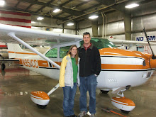
Since we didn't get to fly to Tehachapi last week for the anniversary of our engagement, we decided to try again. This time instead of the winter storm preventing us from getting there, there were some clouds in the valley, but worse there were notices to airmen for ice and 6 inches of snow on the airport. We decided to Rosemond instead, we went there a while ago and they had a great buffet.
Rosemond doesn't have any wind information so I got my wind information from the nearby Mojave airport light out of the east (070@4). Since Rosemond prefers runway 25 in light winds to avoid overflying the nearby houses, I decided to land runway 25 (with the wind). After turning to final I noticed that even though my airspeed was right at my normal approach speed I was significantly faster over the ground than expected. I was able to compensate, but it wasn't the prettiest landing, I should probably intentially practice these. They are not standard landings and are rarely done, but sometimes a downwind landing is safer due to terrain (such as Kernville).
Unfortunately the restaurant wasn't open, they changed their hours to open at 4pm instead of 11am except for Sundays. Great now the last two restaurants we've gone to have been closed, next time I should check! We decided to fly back to Mojave since we've been there more recently and it's a very short flight on the way home. Mojave was open, but they were extremely slow since Scaled composites (Burt Rutan's company) had brought a large party in (we didn't see Burt or Dick). There was only 1 waitress and she was very overworked. The food was excellent as usually and I filled up with cheap gas before we took back off for home.
On the way home, I decided to try to find Kelso valley. Our neighbor lent me a book about flying around here in the olden days. It's a very intersting book to read. A woman wrote the book about her and flying adventures with her husband who flew into all sorts of crazy places; mostly dried lakes and old dirt roads. One of the locations they flew into was Kelso valley and I think I knew where it was. I looked on Google Earth and I think I could see a desert scar from a runway decades ago.
The air was extremely smooth so we flew low over the mountains and I believe I found the right valley. It was easily wide enough to descend down into and land. There were a few homesteads scattered around, but I didn't see the runway. I think it was buried in the snow. After flying over this valley, we cut back over to the Owen's valley and flew back to Inyokern.
Showing posts with label lunch. Show all posts
Showing posts with label lunch. Show all posts
Sunday, December 21, 2008
Thursday, December 18, 2008
Flying to Mammoth, CA
Michelle and I had planned to fly to San Diego on December 13th and to Tehachapi on the 14th, but the weather ruined both of those flights. We were hit with a major winter storm system on the 13th and couldn't fly anywhere and the system lingered in the mountains preventing us from flying to Tehachapi on the 14th. Instead, we decided to fly up the valley to Mammoth where I could get some more high altitude practice taking offs and landings.
Flying to Mammoth also was a good opportunity to test my new configuration for recording the flight. I ordered a ground loop isolator which is just a special cord that was supposed to get rid of the alternator noise in the audio, I modified the camcorder mount, and I bought a digital voice recorder so I could have independent audio of the intercom and the cockpit. I also bought a SPOT messenger to track our flights as safety equipment and this was it's first flight as well.
It was a very scenic flight on the way up with the mountains covered with snow, although there was continuous light turbulence, which just got annoying. I didn't leave the video on the entire flight this time, but instead turned it on once and a while to get different scenery and angles. I really liked how some of the side shots turned out.
Unfortunately, even though I got slightly less dash in the view, there was still more than I had hoped for and the angle was low such that I was usually recording below the horizon. The intercom audio still has alternator noise on it, the cabin noise was worse than expected, and I still have the propeller flying off the screen even though I played with the different frame rates. I still have some work to do when editing it to see if I can improve it at all.
Back to the flight itself, the pattern at Mammoth is pretty interesting. There are tall mountains to the south and a smaller ridge to the north. The winds were 10 gusting to 15 knots from the south-west so I flew the right hand pattern around the smaller ridge to runway 27. I thought that I would always maintain sight of the airport, but I soon found out that as I started my descent on downwind, I quickly lost sight of the airport. It's not until your turning final until you see the runway appear from behind the ridge. This caused me some trouble, but I didn't have my approach fully stabilized since i didn't know where the runway was and I couldn't use my standard power settings because of the higher altitude. I ended up being high and fast on the first approach and floated a long ways down the runway. The second time around, I ended up being short and needed significant power to get back on the glide slope by the time I saw the runway. Long story short, I wouldn't feel bad about doing a straight in approach to the uncontrolled airport in the future.
After two time around the pattern, we decided we better head back to Bishop for lunch since we were both getting hungry. After my 3rd not so wonderful landing of the day, we walked into the lobby of the Bishop airport to find that the restaurant was out of business! The airport is also too far from town for us to walk. Fortunately they had a snackbar there and I was rummaging through that until a lady came in looking for the fuel attendant (who was out to lunch at the time). She was very nice and offered us a ride into town and back for lunch since she would have to come back to see the fuel guy after his lunch. She dropped us off at a very good Mexican restaurant named something Amigos and we were able to catch the bus back to the airport (she had thought it wasn't running).
After lunch we headed back to Inyokern where I made one of the nicest landings in several months. Once I finish editing the video from this flight, I'll post the link here. The SPOT messenger worked pretty good, but I'm still not sure what to think about it. On the way there, there was a 100 mile gap in the tracking from Owen's Lake all the way up to Mammoth, although it did have very good tracking the whole way back. It's absolutely better than nothing, but I really wish it didn't have those gaps. I guess more time is needed to tell how reliable it really is.
Saturday, November 22, 2008
Test flight with our new camcorder
For the past few years I've been watching videos on YouTube of people flying into different areas and capturing their adventures. I've been jealous and wanted to buy a camcorder to tape my own flights, but haven't been willing to spend the money. Michelle and I decided long ago that we would wait until we start our family before we buy a camcorder.
Here is a link to another pilot who posts his flights. This is his flight into Kernville, I figured I'd link this one since this it compares to the flight we just made.
Now that we have a girl on the way, we made the purchase. Granted she's not due until the end of February, but that's just too long to wait. It kind of goes along the lines of getting the new TV in time for the football season and the new camera in time for a long anticipated trip. The anticipated trip is to Panguitch, UT to visit my Uncle Errol and to fly over Lake Powell, the Grand Canyon, Lake Mead, Hoover Dam, and Las Vegas.
We decided that since we have a fancy new HD TV, we wanted to get a nice HD camcorder. We also want it to be digital since we will be posting both flights and videos of our daughter on the web for friends and family to see. The hassle of DV tapes eliminated that category, and since hard drives don't operate at altitude, those versions wouldn't work either. Hard drives rely on airflow between the disks so that the head "flies" between the platters. When the altitude goes up, the pressure goes down, and the head crashes and the disk fails.
This left us looking for a solid state HD camcorder. I also had 2 requirements for flying, an image stabilizer and a microphone input. All the HD camcorders come with image stabilization so that wasn't a problem, but finding one with external audio in was. Canon is really the only manufacturer supporting external audio anymore these days and we ended up with a Canon Vixia HF100.
My airplane just got out of maintenance so I was anxious to get back up and flying so a flight for lunch in Kernville to test the new camcorder setup was perfect. We also decided to take the dogs with us. They've each flown before, but this was the first time they both flew together and Michelle wasn't in back to calm them down.
The dogs did ok, but they both ended up being nervous at some point. Emmett was much worse off, but I think he'll get used to it. He's always not been a fan of bouncing around. When we drive up to trailheads to go hiking, he always lays down in the back of the Jeep, but he's never gotten sick.
The video turned out pretty good, but there are a few things I found that I want to change. I made a little stand the camcorder attaches to that has a sponge between as a shock absorber. I noticed that the sponge allowed the camera to shake more than if it was just attached firmly. The angle also didn't turn out too good, it was looking down too much and the dash takes almost 1/2 of the screen. This also causes issues since it tries to focus on the dash instead of outside. I also want to work on the audio a little. I have it tied into the co-pilot audio jack, but there seems to be a lot of noise in the audio.
I used a trial version of CyberLink PowerDirector to edit the video, but I think in the future, I'm going to try to use Microsoft Movie Maker so I don't have to pay for the software. I decided to shoot the trip in HD since I had more space on the card than the battery would last. The video was incredible when it was focusing on the terrain. After editing and down converting to HQ, the file was about 10 minutes and 652 Mb. Good thing YouTube just started allowing up to 1Gb uploads... It took about 1 hour to render the video on my PC and the clip is still trying to upload after almost an hour.
Tomorrow I'll be working on the attic since I spent all day playing...
Subscribe to:
Posts (Atom)