I came across this site a few times before and thought it was interesting. I can mark all of the airports I've been to, flown into commercial or private or whatever, but I'll use it to mark airports I landed at as the pilot.
I just started playing with it and only have a few airports listed now that I remember off the top of my head. Some day I'll go back in and complete the list as well as try to keep it up to date. What would really be nice is if I could attach pictures to each icon to show what we did there. Maybe I'll have to re-create this as a Google map with landmarks and photos instead to get there.
http://www.ourairports.com/big-map.html#lat=39.34795,lon=-104.7353,zoom=4,type=Terrain,member=Jayson.Brouchoud
UPDATE:
I started to mess around with creating my own Google Map. This is what I have so far.
View Larger Map
Click here to bring it up in a separate window.
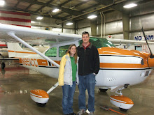
The blue markers are for airports that I have landed at and the red markers will be for pictures that were taken while flying. I don't have even close to all of the airports included and I only have 1 in-flight photo so far. By using the Google map, I'll be able to associate text, photos, and videos with airports as well as include links to photo albums associated with that trip. I am hoping this will develop into a geographically orientated diary (versus chronologically).
Monday, August 11, 2008
Subscribe to:
Post Comments (Atom)


Note to self: I think that you can make a "My Map" with google and label the airports with either markers or phots. You can add placemarks for all the airports you've landed at and add photos and links to the placemark.
ReplyDelete